Blog

April 29

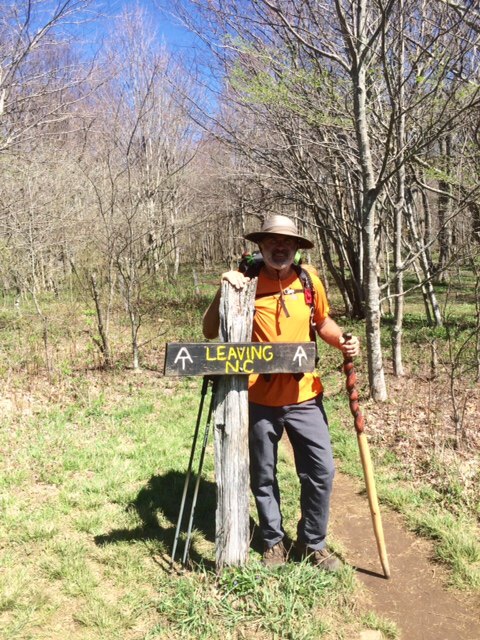
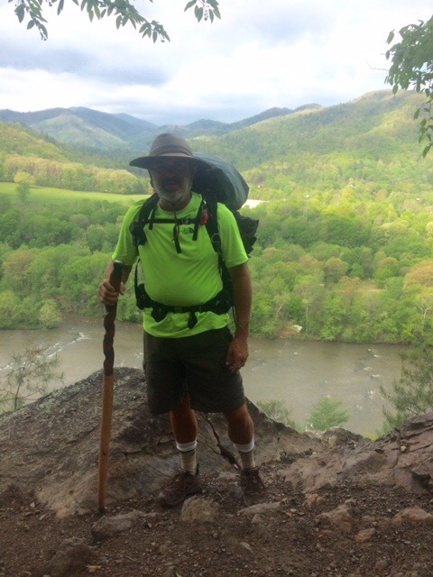
Day 30 Hwy 19E to White Rocks Mtn (21.7 miles) 415.4 total miles

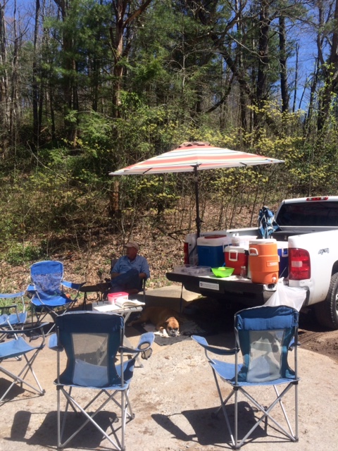
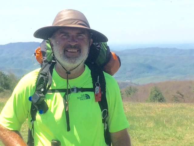
Stayed in Newland, NC last night. Hitched a ride back to trail. Probably hitched 6 rides now. Get picked up by pickup trucks more than cars and usually have me ride in back!

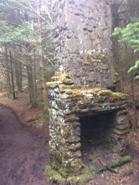
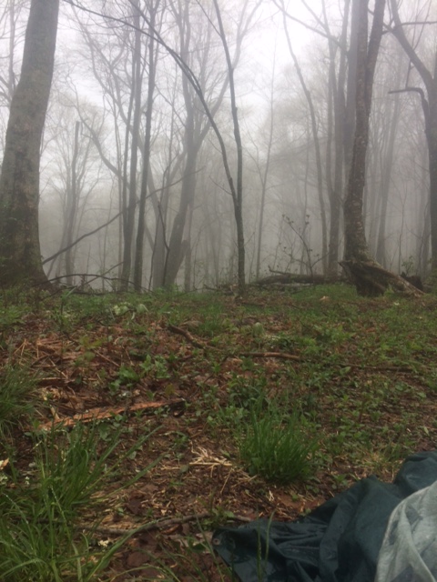
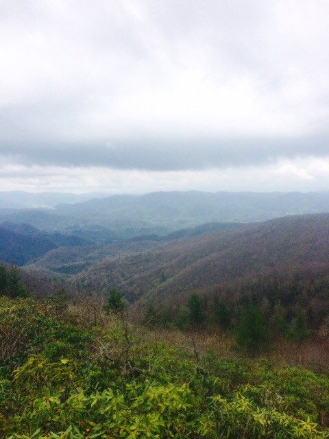
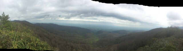
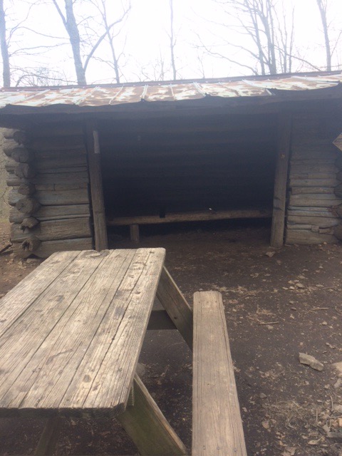
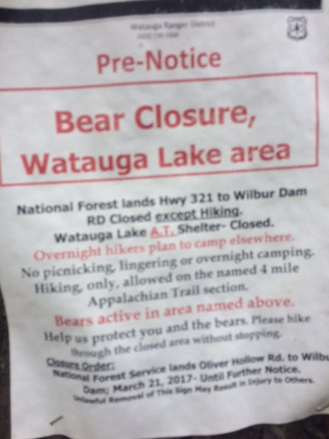
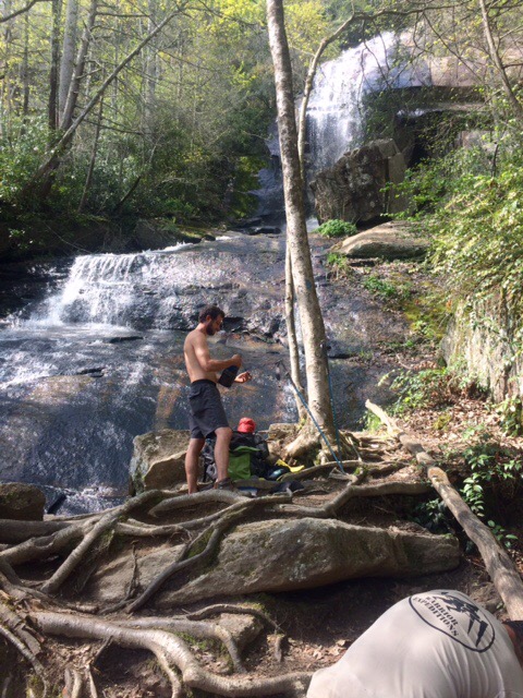
Guess I won’t be staying here!


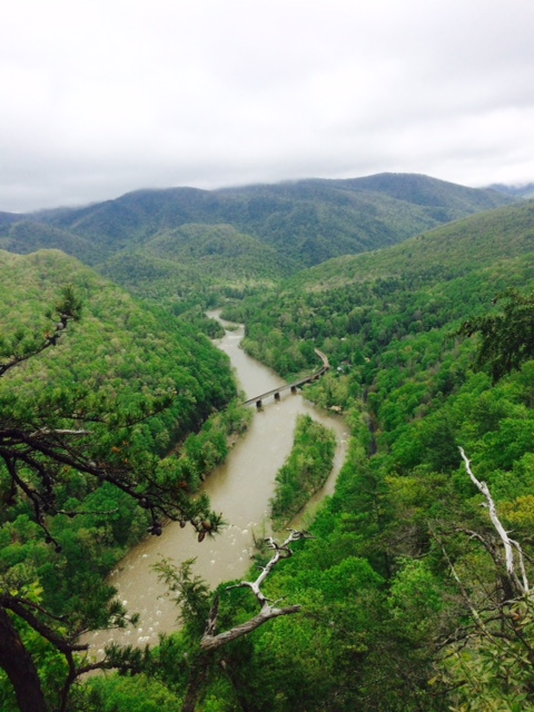
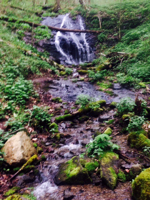
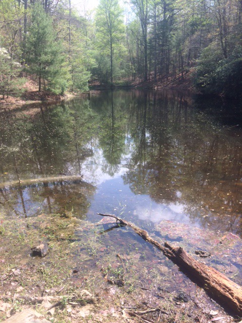
Below is Jones Falls. Little swimming hole at bottom of falls. Some hikers took a dip but a little too chilly for me.


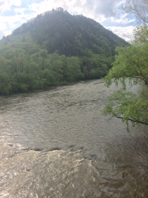
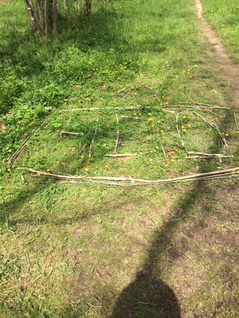
Passed mile 400. Marked/written with sticks.


Put in 9.5 hours of hiking today. That’s a lot of steps! I don’t have a FitBit but I would guess over 40,000 of them.


Used my stove for 3rd time. Freeze dried pasta with sausage. It was OK but stove may get sent home. After I’ve hiked all day and gotten tent set up, I’m not too excited about getting stove out. I enjoy my tortillas and peanut butter as much as anything I’ve cooked.

Will try to get in another 20 miles today!

Happy trails!

April 28

Day 29 Stan Murray Campsite to US 19E (11.8 miles) 393.7 miles total

Nice, sunny day and beautiful vistas. Nice day of hiking. Especially when you know you’re hitting a town!

This view is from Yellow Mtn (elev 5271). There was a Revolutionary War battle near here at Yellow Mtn Gap.

The views today were so nice because it was sunny but there was a lot of time on the balds. This is the walk to Little Hump Mtn. Trail looks, and basically is, like a cow path across a pasture in SD.


View from top of Little Hump Mtn.


Now we’re heading to the top of that one…Hump Mtn (elev 5587).


I get virtually all my water from piped springs. PVC directly from mtn. I don’t filter it when I get directly from source of spring. Always cold and tastes great!


Finally out of NC. About 70 more miles and out of TN and into VA.


Next stop Damascus, VA. 75 miles. Hoping to do it in 4 days. That will take good weather.

Happy trails!

April 27

Day 28 Apple Orchard to Stan Murray Campsite (17.7 miles) 381.9 total miles

Didn’t quite make it as far as hoped today. Got soaked by heavy rains last 2-3 hours of hike. Rain quit about 5PM and I found a place to pitch tent shortly after. Walking in rain is no fun but setting up camp in rain really stinks!

Saw my first bear of hike today! See if you can find him in this photo. Hint: I am not Ansel Adams and this happened fairly quickly.

IMG_0537

Upper right corner of photo. He is up in tree. First heard noise when he was climbing tree. Fast climbing up…really fast coming down! We eyeballed each other for a couple minutes and then he was off. Pretty impressive to watch run/saunter through this terrain. Him again top-center below.

IMG_0538

Very foggy and windy almost all day until it finally rained.

IMG_0539

This abandoned chimney is still standing by itself in middle of nowhere. Makes you wonder it’s story. Obviously well constructed.

IMG_0541

Today I’m hiking about 13 miles to Roan Mtn, TN. Dry place to sleep awaits!

Happy trails!


April 26

Day 27 Nolichucky River to Apple Orchard (21.5 miles) 364.2 total miles

Nice, sunny day. Hiking by 9:30. Ran into some trail magic about 9 miles in. Brother Tom had lemonade, sweet iced tea, brownies, and some really good banana bread. One of the best things with trail magic is being able to sit in a chair! Brother Tom keeps a guest book and told me last year he served 1300+ hikers.

FullSizeRender (31)

Still amazed by the big views and the abundance of protected mountain and forest areas. I am not a “tree hugger” but we, as a country, need to keep these areas protected from development.

FullSizeRender (32)

I am starting to develop a trail name. I don’t believe one should give them self a nickname, as probably 75% of people out here do. Introduce myself as Pete. When they ask what my trail name is, I respond “Just Pete”. Some people now calling me Just Pete.

FullSizeRender (33)

Got in another 20+ mile day. Get pretty tired and sore by end of day but feels really good to finish! Camping by myself at old apple orchard. There are at least a dozen old apple trees still here. They are in blossom now.

FullSizeRender (34)

Sleeping in tent without rain fly on for first time. Can look straight up from sleeping bag to stars. Big Dipper is straight over my head and is very big and bright.

Will try to do another 20 miles tomorrow.

Happy trails!


April 25

Day 26 Spivey Gap to Nolichucky River (11.1 miles) 342.7 miles total

Good day for hiking. Foggy most of hike. Temp in 50’s. I also was able to “slack pack” as was able to leave tent, sleeping bag, food, etc. at hotel as returning tonight. Pack was probably half of normal weight.

Drought in NC/TN mountains officially over. Streams and rivers running fast.

FullSizeRender (27)

Having 18 lbs in pack instead of 36 makes navigating obstacles like this easier! At least 3′ in diameter and I sure wasn’t taking the extra steps to walk around!

FullSizeRender (28)

The Nolichucky River from up above.

FullSizeRender (29)

Uncle Johnny’s Hostel is right at the river where I exited trail. Cool looking place. Lots of younger folks. Shuttle driver picked me up and gave me ride to Super 8!

FullSizeRender (30)IMG_0525

Thru-hiker life. Sun came out late afternoon and a trekking pole ball game breaks out in parking lot. Note all the tents, etc. drying in foul territory.

IMG_0529

Next destination, Roan Mtn, TN. It’s 51 miles. Hope to be there in 3 days. Weather for tomorrow is supposed to be sunny. 50% chance of thunderstorms Th.

Happy trails!


April 24

Day 25 Sugarloaf Gap to Spivey Gap (20.1 miles) 331.6 miles total

Woke up this AM to no rain. Think it rained between 3-4 inches yesterday.

Little bit of sunshine today! Decided to go big distance today and hitch ride to Erwin, TN where I can get room and dry everything out.

FullSizeRender (23)

Still following NC/TN border. Hiked in NC all day…I think. Crossed under I-26 and saw welcome to TN sign about 50 yds from me. Also staying in TN tonight.

I think these balds are really cool. I try to envision cattle grazing. Below is Big Bald (elev 5516 ft). Was pretty windy and chilly walking across there.

FullSizeRender (24)

I got to Spivey Gap about 4PM. Hwy 19 runs right there so I was hoping to hitch ride the 15 miles to Erwin.

When I got there, 3 thru-hikers were waiting alongside road for shuttle to hostel in opposite direction I’m heading. They told me 2 cars had passed by in 45 minutes they’d been there. Hitching not looking good!

Had phone number for shuttle service but not enough signal to get call through. Starting to get nervous. Don’t want to spend night in tent!

Tried texting and it went through. Nice guy who’s hiked trail twice gave me ride. Giving me a ride back out to same spot in AM.

FullSizeRender (25)

All comfy at Super 8. Will go out tomorrow and finish last 11 miles to Erwin and then stay again tomorrow night. Living large!

FullSizeRender (26)

Happy trails!

April 23

Day 24 Sugarloaf Gap Zero Day

It’s rained for 26 hrs straight and still going. I’ve been hunkered down in my tent all day. This sucks!

When I woke up this AM had cell service and was able to get weather forecast. 100% chance of rain most of today (they were right!).

IMG_0509

Rain chance for Monday and Tuesday is in the 50 – 70% range. New plan is to try to make about 7 miles to a road where I should be able to get into Erwin, TN.

Tent has held up well. No rain inside but everything still getting pretty damp. There is barely room for my stuff, along with myself, inside tent when it rains like this. Pretty tight quarters for 36 hrs straight.

IMG_0510IMG_0511

Wish me luck in AM.

Happy trails!

April 22

Day 23 Little Laurel Shelter to Sugarloaf Gap (18.5 miles) 311.5 total miles

Thunder, lightning, and rain last night. Rain for about 3 hours of hike today. Started raining right as I stopped to set up tent tonight and still raining now.  

Pretty sure it’s rained 6 straight days and I’ve been hiking 5 of them. If you are having drought issues in your area, give me a call and I’ll come hike through. Gotta just about have the issue here in SE about fixed!
If you’re able to zoom this pic in, you will see the first flat stretch of farm land I’ve seen. Just wish I was hiking down there.


This has been my toughest day of hiking yet. Didn’t have much pep in my step this AM and the hike was much more difficult than topography map led me to assume. Then add some rain and slippery surfaces.


Below is my attempt at a panoramic shot. Might have needed an assist from my friend, Legs, for this one!


As I mentioned earlier, the terrain today was much more difficult than I had guessed. Not so much because of up and down hills but because of having to scramble over rocks…in the rain and wet. Had to climb down into that little gully and then straight up other side.


Slipped and fell on my butt twice today. No injuries, thankfully.


Found a place to camp just as rain started this evening. Pretty cold. Summer sausage, peanut butter, and a Snickers bar for dinner. Living large!

Hope for better day tomorrow.

Happy trails!

April 21

Day 22 Hot Springs, NC to Little Laurel Shelter (19.6 miles) 293.0 total miles

Kind of tough getting up and going this AM but eventually got hiking about 9:30 AM. 
Completed my fifth half mile walk to town from chalet. There were also 5 walks from to chalet from town. It’s not that it’s a hard walk, it’s just the principle of it. I don’t need any extra walking!

Hot Springs is nestled along the banks of the French Broad River. In about an hour I’ll be on top of that Mtn across river.


Got to walk a ways right along river. Several tents with people who camped along river instead of staying in town.


Lovers Leap Rock. Why do they always talk about jumping/leaping from these rock outcroppings??


A dammed up pond that I’m guessing was used for cattle at some point. There is area near that was cleared of trees and maybe used for grazing.


Spring Mtn Shelter (below) is one of smallest shelters I’ve seen. Sleeps 5. Most are 10 – 12.


Rained pretty steady for 3 hrs in afternoon. That’s 4 straight hiking days with some rain if you’re keeping track at home.  

Tented by Little Laurel Shelter. Very appropriate as we live on Laurel Lane in a little house!

Happy trails!

April 20

Day 21 Hot Springs, NC Zero Day

A day of rest is a good thing. Lolled around most of AM. Chalet would be perfect if had TV and was not a half mile walk to town.

Below is a hiker room when they come in from hiking in rain and need to dry stuff out.

FullSizeRender (14)

Nice, peaceful setting from the deck of chalet. Truthfully, I’d exchange view for ESPN and CNBC!

IMG_0482

Tiny house…big grill.

FullSizeRender (15)

This is Alex (“Big Foot”). He is the U of NH guy I met day 1 and have seen a few other times. I hadn’t seen him for more than a week and assumed he was far ahead of me. He hiked through Smokies with brother so slowed him down. He is quite surprised some “old guy” is keeping pace. Tortoise and the hare!

IMG_0488

Ready to hit it in the AM. Next destination is Erwin, TN (about 70 miles).

Happy trails!