April 7

Day 8 Dicks Creek Gap to Standing Indian Skelter (16.7 miles)

Took shuttle back out to trail and was hiking at 9AM. Felt good to be moving again.  

It’s cold (low 30’s) and windy. First day I’ve hiked in a jacket. Gloves on too. One side of Mtn you can’t even feel wind. Other side, it about blows you over.

Made it to GA-NC border about 1:30PM. 1 state down, 13 more to go!


This tree is just into NC. Guessing it’s been here a while.


Little snow covering trail. Still from last night so hasn’t warmed too much today.  


Pitching my tent for night in snow! Building in background is shelter. Guess we’ll find out how warm my tent is!


Hope to hike another 16 miles tomorrow then easy 7 miles into Franklin, NC on Sunday.

Happy trails!

April 6

Day 7 Hiawasee, GA Zero Day

Spent the afternoon watching the Masters.

Ready to get rolling tomorrow AM. Feel all rested and a lot fresher legs. Supposed to be cold but that only matters at night (low 30’s Fri night).

Some random thoughts from a bored hiker:

It’s always nice to run into hikers you’ve seen before. You talk about where you started the day, where you are heading to, how much the last mtn sucked, and complain about any piece of gear you’re not happy with. I’ve got 2 guys I’ve run into several times: Alexander (Big Foot) a recent grad of U of NH. Played OG on football team. He makes me feel like a tortoise but we seem to end up in the same spots. Rick (from Omaha) is about my age. Here I’m the hare but, once again, we end up at same spots.

Backpack and walking stick are 2 items least likely to forget. It just feels weird to walk without pack. The walking stick (approx 95% of hikers use trekking poles) I notice within 10 steps if missing.

The shuttle driver I had Wednesday is an experienced thru-hiker. Said on a difficulty scale of 1 – 10, what I just finished is a 4. Buzz kill! I thought that was hard. From here through Smokie Mtns, he said is a 6. So, I got that going for me…which is nice!

April 5

Day 6 Hiawasee, GA Zero Day

It kind of stinks to hike 0 miles but the weather today has been rain with tornado watches. Glad I’m not out in that plus has been good rest for feet and legs.

Weather tomorrow is more rain plus getting colder. Chance of snow Th night/Fri AM. I’ve decided to take Th as a zero as well.

Will be able to watch opening round of Masters tomorrow. Plan to hit the trail Friday AM and reach Franklin, NC (about 40 miles) on Sunday in time to watch final round.

I have a big editorial correction to make. Randy? Is the Trail Angel who gave me the water on day 3. Problem is Randy? Is really John Baugus. My bad! Luckily I had given him my website info and he’s following my blog. Thanks again, John!

Today I made a reconnaissance mission to lone sports bar in Hiawasee to make sure it would be appropriate spot to watch Masters tomorrow. Got to watch Twins go to 2 – 0 plus met gentleman below.

Sandy will be 94 this month. WW 2 Vet who served in US Navy from 1942 – 47. Gets around great and sharp as a tack. Makes a 3 hr tour (still drives) every afternoon. 3 bars, 1 small beer in each. Fun to talk with.

IMG_0308

“Worst to First.
It was done in ’91.”

Go Twins!

Somebody please get me copyright, or whatever I need, for that one!

Happy trails!

Maryland Golf & Country Club

MGCC is located in Bel Air, MD. We lived near there and were members there from 2004 – 2011.

We (well, OK, mostly me) had some epic times there. We still have some great friends there.

They are showing their support through many pledges to the charities I’m hiking for and this unique tracking system (below). Wouldn’t be surprised if there are some games of chance also being played!

Thanks to everyone at MGCC for your support. I’ll see you in September for Member/Guest unless T-Ball fires me!!

April 4

Day 5 Unicoi Gap to Dicks Creek Gap (16.7 miles)

Caught a shuttle from Hiawasee to Unicoi Gap (where I finished yesterday). Before I left hotel I booked room for 2 more nights. Weather tomorrow is bad. Thursday not much better. I’m ready for a zero day. Legs are pretty dead after today’s long hike. Won’t hike tomorrow and will decide on Thursday sometime tomorrow. Hotels around here are packed as lots of people getting off trail.

Some of the people on my shuttle this AM pictured below. Note the big German dude in the kilt!

IMG_0297

This is the AT plaque at Unicoi Gap.

IMG_0298

Lot of steep ups and downs today. Probably why I’ll have a tough time getting out of bed tomorrow!

IMG_0300

This is from top of Rocky Mtn (elev 4017). That was a gain in elevation of 1100 feet in 1.4 miles. My exact thought while taking this pic “I hope the Trail doesn’t go over peak in distance”.

IMG_0301

This is from the top of Tray Mtn (elev 4430). 3 more mountains to cross then downhill to Dicks Gap.

IMG_0302

Finished hiking about 4:30. Hiawasee is about 11 miles from Dicks Gap and was going to try to hitch a ride but a shuttle driver pulled up right away and gave me ride for $10.

Looking forward to a day of rest for my feet and legs…and to watching storm from indoors vs tent!

Happy trails!

April 3

Day 4 Lower Gap shelter to Unicoi Gap (9.7 miles)

Well, they were right about the rain. Started at 6 AM and light rain with some downpours mixed in all day.

Started out shortly before 8 AM. Yesterday was physically challenging. Today very mental. The below is early AM light rain with a little fog.

IMG_0278

I have a rain poncho that covers myself and pack. Sounds good in theory but was a pain. Very difficult to get on by yourself. Tried putting on before and after I had pack on. Neither good…but everything pretty dry.

IMG_0284

It may be difficult to see in photo below but the trail was virtually a river on steeper portions.

IMG_0291 (1)

At Unicoi Gap I was able to get a ride from a shuttle driver to Hiawasee, GA. Staying at Budget Inn tonight. $40 cash rate. Been able to shower, wash a load of clothes, and eat at Subway. Living large!

IMG_0293

Almost forgot…and getting a pizza delivered to go with my 6 pack of Bud.

IMG_0295

Hoping to make 16.7 miles tomorrow. If I can, will be able to sleep in a bunkhouse. Weather is supposed to be good tomorrow but iffy rest of week.

Happy trails!

April 2

April 2 (Day 3) Neel Gap to Low Gap 11.5 miles

Hit the trail about 10 this AM. Not a lot of miles because of late start and rough terrain. Crossed 4 mountains today! That’s a lot of ups and downs!

IMG_0270

unnamed

The smoke you see in photo below is taken from Levelland Mtn. Quite a ways from my location but doesn’t look very contained!

unnamed (1)

This is Cowrock Mtn. Met a guy (Randy?) around here dressed in camouflage. Hunting turkey and wild boar. Said will only shoot boar if within a mile of where he can drive to.

unnamed (2)

My destination was 6.5 miles from Cowrock. Randy? warned me that a couple of springs I was hoping to get water from were dry a month ago.

They were! Luckily I ran into Randy? at a parking area I passed through. He gave me his extra water as he was done hunting for the day. Trail Angel. I would have been in tough shape if not for him.

unnamed (3)

Tortillas have become my staple at meal time. I’ve had plain tortillas, and tortillas with deer jerky, tuna, and peanut butter. Tonight I got a little wild and made freeze dried beef stew. Pretty tasty!

Supposed to rain tomorrow. That sucks. Some people are going to spend day at shelter/campsite. I plan to hike as of now.

42.9 miles down! Happy Trails!

April 1

April 1 Justus Creek to Neel Gap

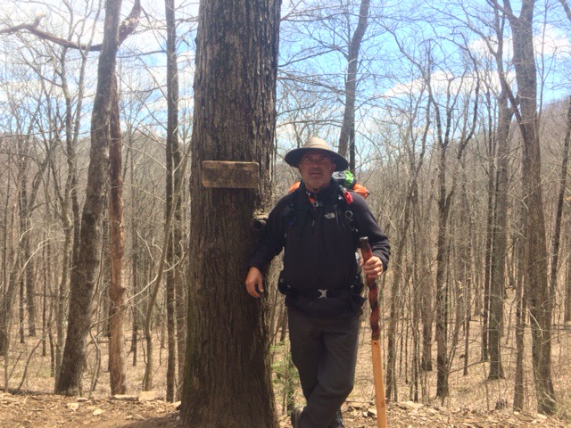
Got packed up and moving shortly after 8 this AM.

1.8 miles down the trail I reached Gooch Mtn Shelter.  There is a privy there.  Much preferred to holes in the woods!

IMG_0254 (1)

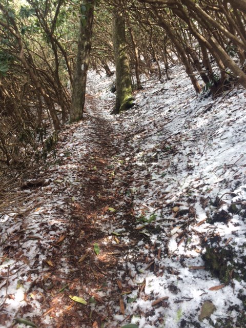
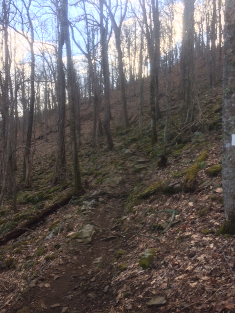
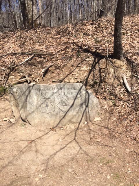
Shortly after Gooch Mtn is Gooch Gap. Gaps are basically valleys between mountains. You go down to the Gap and then up another Mtn. This is Ramrock Mtn (elevation 3222 ft). Not high by western standards but there are some physically challenging stretches.

Uphill vs downhill…Both kind of suck! Uphill kills your lungs. Downhill hurts your feet, knees, thighs and hips.

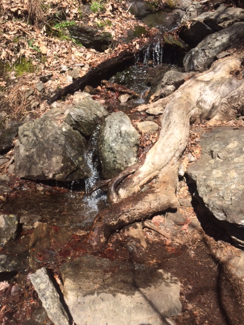
I’ve been drinking water straight from streams. Crystal clear, cold, and tastes great. Not purifying yet because it tastes too good. Only getting from higher elevations.

IMG_0257

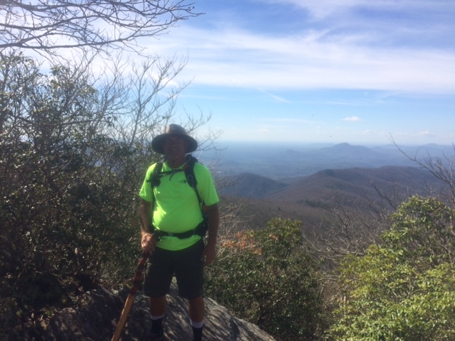
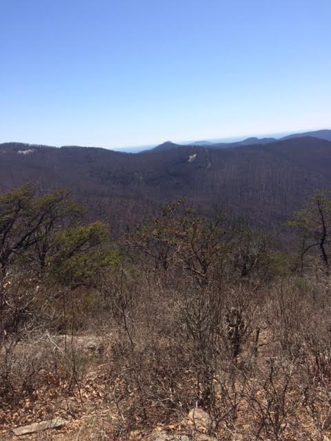
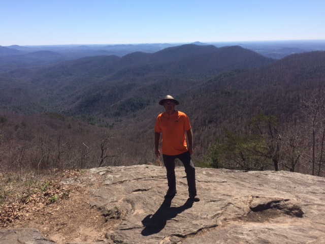
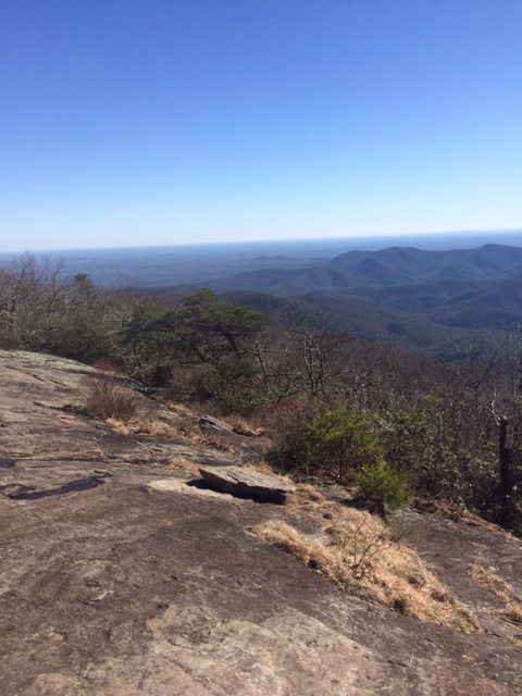
Had lunch at top of Big Cedar Mtn (elev 3737). Met 3 young thru-hikers. Shared some of my snacks with them as I am carrying way too much food. They thought deer jerky was “righteous”!

IMG_0258

Big decision of hike so far…Bear canisters required for camping between miles 26.4 and 31.4. I don’t have canister (too heavy) so stop before or stretch it through. These 5 miles would be over tallest mountain in GA so would probably take at least 3 hrs. Decided if I got to beginning of area by 3PM I’d go for it. Got there right at 3 and went!

IMG_0261

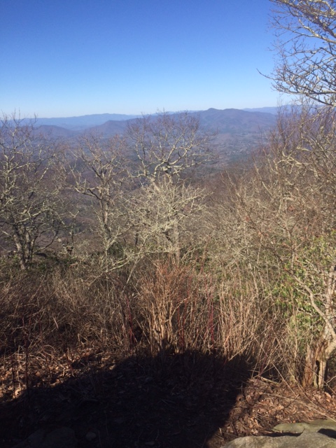
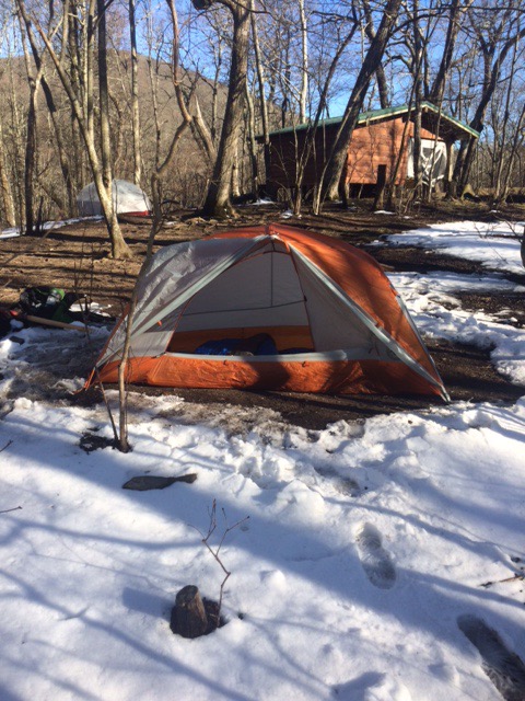
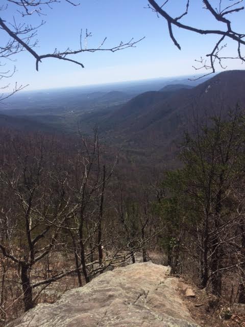
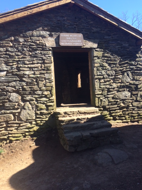
Brutal hike up Blood Mtn. Got to top about 5. Below is shelter on top of Mtn. Very nice structure but if sleeping there it is concrete floor. Definitely not a Marriott!

IMG_0263IMG_0266

Hike down the mountain took slightly more than an hour. Just slightly enough that I missed chance for shower, laundry, and bunk by 3 minutes. There is an outfitter with a bunk house at Gap. Unfortunately for me they closed at 6PM. I’m camping tonight about 1/4 of mile from there so will walk in and at least get a Coke in AM.

Couple of good blisters today, one on inside of each heel. Other than that, feel good.

Neel Gap is the spot where 25% of thru-hikers quit. So I kicked their butts!!

March 31

March 31 Springer Mt to Justus Creek (14.3 miles).

Hiked first mile with Kris, Brooke and Kerri.
Lower elevations (below 3000 ft) was like walking thru a forest of rhododendrons. Not flowering yet but sure spectacular when they do.

Had a snack and break at Long Creek Falls. Very cool.

6.2 miles in I ran into my first “Trail magic”. A group of local people had table with drinks and snacks. As I had just eaten something 1/2 hr before I just enjoyed a Coke and a chair (which felt great).

There are a lot of places to stealth camp (not in designated spots). Some look to me like high odds of sharing with bears!


Arrived at Justus Creek about 5:15. This was my optimistic ending point for day. Didn’t know if I was going to make it there as supposed to cross dirt road 1 mile from Creek/campsite. Didn’t see that road but saw a place by a Creek that looked campable. Just set my pack down and a hiker came down from campsite to get water. This was Justus Creek thankfully.

Got tent set up, had some deer jerky and in bed by 6:30. Physically feeling good. No blisters yet.