May 12

Day 43. Stealth Stream to Cross St (22.1 miles) 634.3 miles total

The mountains kicked my butt today. By far the most difficult day of hiking yet and not because of the terrain.

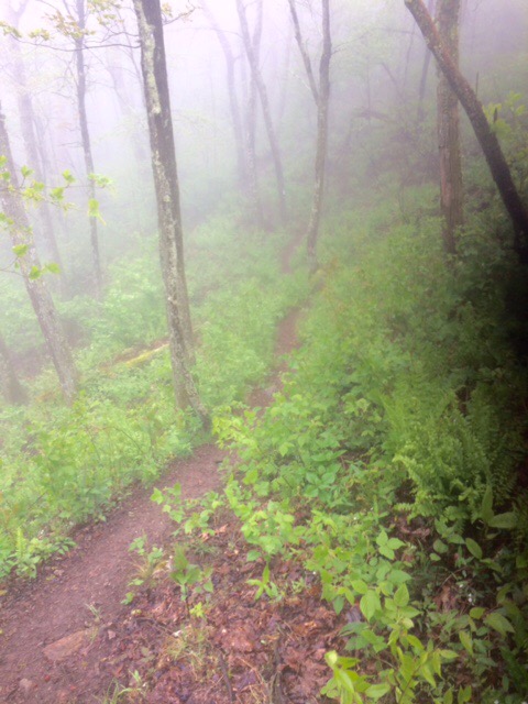
I started hiking at 8:30 hoping to finish 22 miles to Pearisburg about 4:00. Temp about 55, fog and drizzle.

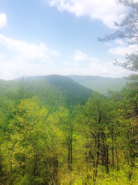
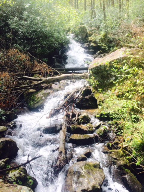
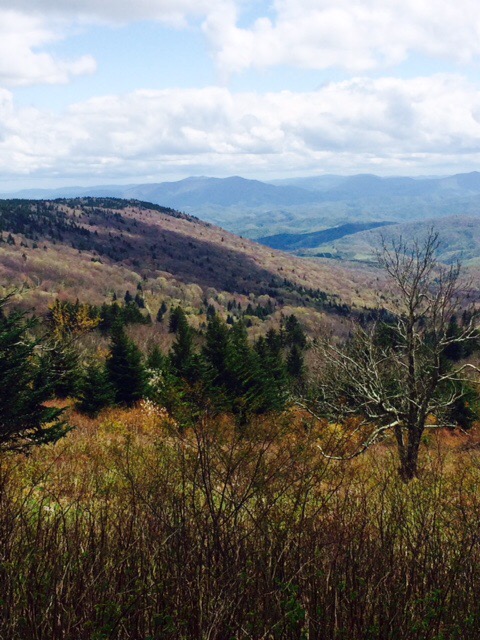
The trail was a sloppy mess. Water and mud all over because of last night’s rain (along with last 3 week’s). My shoes and socks were very wet early in the day.

The undergrowth of the forest is filling in. You now brush against some of this growth as it encroaches upon trail. When it’s wet, you get wet!

At 2:00 I was still 8+. miles out. Still foggy and drizzle. Probably a little cooler as well. Now I’m starting to hear thunder. Checked my guide book to see if any road crossings between here and town where I could be picked up by shuttle if necessary. No such luck.

By 3:00 it was ugly. Steady rain and temp dropping. Progress is slow and it will be at least 2 hours until town.

Now I am really questioning why anyone, especially me, would do this. I should be just finishing golf and heading to The 19th Hole for a few Budweisers!

Your pledges and the charities I’m hiking for kept me going.

The last 2.5 miles were brutal. Still raining and now Iin mid-40’s. My hands are freezing and water sloshing in shoes. Have gloves but they’re deep in backpack.

I lumbered through the last mile slipping and stumbling. Finally saw the road that leads 0.7 miles to town. Trail got steep and very slippery at end. Of course I slipped and slid about 10 feet through mud. Now I’m freezing and covered in mud!

I walked that last .7 miles as fast as a frozen, muddy person can. Got to hotel at 5:30. My hands were so cold it took 5 minutes before I could operate a pen to sign in.

Soaked in hot shower then went across street to Mexican restaurant. Several Buds and a carnitas dinner later and feel much better.

Cloudy tomorrow with chance of rain early. I will be taking day off and watching The Players Championship. Not a planned day off but I deserve it!

Sun in forecast Sunday through Thursday. Can’t wait!

Happy Mothers Day to all moms.

Happy trails!

May 11

Day 42 US 52 to Stealth Stream (22.1 miles) 612.2 miles total

We have now raised more than $15,000 for the charities I’m hiking for. With pledges totaling $25/mile, we’ll get to $55,000…assuming I am able to make it to Maine. Thanks to each of you for your support. Your generously amazes and inspires me.

Hostel stay was OK except for the fact that proprietor almost forgot to do my laundry (included in price) and TV didn’t work this AM!

Got to trail about half hour later than planned due to laundry delay. Not raining which is nice.

View leaving Bland.

FullSizeRender (75)

I made a stop at Trent’s Grocery this afternoon, Trent’s is in middle of nowhere but only half mile from trail. They are known amongst hikers for their burgers. Well worth the stop and was even able to hitch ride back to trail.

Rain began about 6 so I set up camp soon after that. Couple miles short of where I was hoping to be. 22 miles tomorrow into Pearisburg.

Forecast for tomorrow is more rain. Starting to wonder if I am supposed to be building an ark instead of doing this hike!

Happy trails!

May 10

Day 41 VA 623 to US 52 (15.8 miles) 590.1 miles total

Pretty good thunderstorm during night but partly sunny by morning.

Met a group of Amish men and boys shortly after started hiking. Couple of the men asked me questions about my hike. The young boys just stared at me. One of the guys gave me some Oreos and told me to look for a white van by road up ahead and ask lady for a soda.

Lady was their driver (not Amish) and she did have a Mtn Dew for me. Yahoo! She was also very interested in hike.

At Laurel Creek I ran into Butter (guy who did SOBO couple yrs ago and now NOBO). Tented next to him in Smokeys. Also saw him in Hot Springs and Damascus. I hike faster than him but he’s obviously tougher. Hasn’t taken a zero day since Hot Springs, NC!

FullSizeRender (70)

Hiked with Butter for about half hour. First time hiking with anyone for any period of time. He’s into sports so we had a good conversation cobbling together baseball season so far.

FullSizeRender (71)

Hike today looked pretty flat on topography map but realizing that is irrelevant as there were small, steep ups and downs…and a lot of them!

FullSizeRender (72)

Got down to town at end of day and ran into more trail magic. Enjoyed a soda while waiting for shuttle to get a ride to hostel. That’s Butter in lower left.

FullSizeRender (73)

Stayed at Zero Days Inn Hostel. I paid $45 for Hiker Suite. Private bedroom with a TV. My kind of hostel stay! Most of these hostels are owned/run by former thru-hikers.

FullSizeRender (74)

Weather tomorrow is cloudy with chance of showers. More rain on Friday. 44 miles to Pearlsburg, VA. Hoping to do that in 2 days.

Happy trails!

May 9

Day 40 VA 610 to VA 623 (20.3 miles) 574.3 miles total

My tent last night was in a pasture and near a stream. Were you aware that cattle get thirsty in the middle of the night? I was awaken by what sounded like “the running of the cows.” Scared the crap out of me. Turns out was only about a dozen but sounded like hundreds thundering past.

Watched the rain from my tent until almost 10AM. Quit for a while so I got moving. Fog and drizzle all day.

Not a good day for pics. Below is a fence stile. At least that’s what they call it in these parts. I might call it a fence ladder, but that’s just me.

IMG_0638

Got about 16 miles today into Bland, VA. Forecast is for scattered showers.

Happy trails!

May 8

Day 39 Mt Rogers Visitor Center to VA 610 (21.8 miles) 554.1 miles total

I must confess that I’m not sure exactly where I am. I know that I’m along the trail but could be up to 2 miles farther than I said. More on that later!

Good day for hiking. Sunny and upper 50’s.

Forest floor is greening up and hills keep going up. This is the trail up to Glade Mtn. Steeper than it looks in pic plus there were 5 switchbacks with similar climbs. You get to end of one thinking you’ll be at top, trail turns and you go up some more.

FullSizeRender (59)

Trail magic provided by a United Methodist Church. This is the Lindamood School, a 1-room school from 1894 that is part of a Settlers Museum along trail.

FullSizeRender (60)

First rhododendrons in bloom up in Mtns. Hoping to see forests of them in bloom as I go.

IMG_0634

Trail went through small town (couple gas stations and restaurant) of Atkins, VA. Was able to stop at Barn Restaurant for a burger middle of day. That’s a bonus!

Made it to the 1/4 finished point. Physically feeling really good. Just sore feet which I’m guessing will be case until Maine!

FullSizeRender (61)

The trail crosses through some private land along the way. I am in a 14-mile stretch that is through people’s pastures, etc.

IMG_0637

When hiking, you should note the time you pass certain landmarks. That way, by time, you will know approximately how far from that point you’ve gone. Well, I didn’t do that late today.

Know that I crossed VA 610. Next landmark is VA 42, 2.4 miles away. I am somewhere between there with my tent set up in a pasture!

Chance of rain for next 5 days. 36 (or so) miles to Bland, VA. Hope to be there in 2 more days if rain isn’t too bad.

Happy trails!

May 7

Day 38 VA 603 to Mt Rogers Visitor Center (21.7 miles) 532.6 miles total

Good day today. Slack packed and weather was good so did 21.7 miles in 7 hrs. That’s moving pretty good for me. Need terrain like today…more down than up and not a lot of rocks and roots.

All the streams are flowing good. Have to rock hop across some streams. Degree of difficulty goes up with water level. Light pack makes much easier.

Dismal Creek Falls…not so dismal today!

unnamed

Partnership Shelter is very near Mt Rogers Visitor Center. Really nice Center and you can have pizza delivered to shelter from Marion.

image1 (1)

Weather tomorrow sounds good. Hope to cross the 26% complete point sometime tomorrow afternoon.

Next stop is Bland, VA. Hope to be there Wed.

Happy trails!

May 6

Day 37 Old Orchard Shelter to VA 603 (1.7 miles) 510.9 miles total

Cold, windy, and rainy last night. Not fun! Disappointing day.

You can see the frost line (those aren’t clouds) on below pic. Tented a couple of hundred feet below there. Brrr!

Tented next to 3 guys (Bob, Ed, and Dave) from Fairfax, VA last night. Since forecast for tonight is cold with possible snow, they are cutting their weekend camping trip short. They offered me a ride into town…and I took it!

Hiked 2 miles on AT and then another 2 miles to parking lot. Thanks again for the lift, guys!


This weather keeps screwing up my plans.

Tomorrow I’ll get a ride back to where I came off trail and then hike the 21 miles back to Marion, VA. Good news is I’ll be in same hotel room tonight and tomorrow night. That means I can slack pack (light backpack) because am able to leave most of my gear at room.

Weather for tomorrow sounds decent!

Happy trails!

May 5

Day 36 US 58 Campsite to Old Orchard Shelter (22.8 miles) 509.2 total mile

Windy and rainy most of night but woke up to sunshine. Looking like a good day to get some miles in.

Got hiking early. Motivated. Clipping right along until 1 mile into day I run into trail magic.  

4 guys who had thru-hiked last year had eggs, pancakes, and anything else a hiker can crave. I was one of the first there. Stayed for about 45 minutes and, when I left, there were about 20 people there. Hosts were hoping people would spend Cinco de Mayo there.


Buzzard rock.


Near Mt Rogers, VA’s highest peak (5729 ft).


Entering Grayson Highlands State Park. Known for wild ponies. I probably saw at least 3 dozen ponies in the 3 mikes trail went through Park.


After leaving the park, had to have a discussion with this guy regarding trail etiquette and who had the right of way in this instance.


Last part of day, trail was very wet. Must have rained a lot more here than it did on me today. Started raining again about 6. I stopped and pitched tent about 7:30.

Rain, wind, and cold. Hope it’s nicer in AM. Still 23 miles to Marion, VA.

Happy trails!

May 4

Day 35 Damascus, VA to US 58 Campsite (17.2 miles). 486.4 total miles

Very windy today. Good thing is half the time you’re on protected side of mtn so you don’t feel it.

Didn’t make it as far as I’d have liked. Started raining late afternoon so stopped at first camping area I came to after rain began.

FullSizeRender (58)

Hope to get in big miles tomorrow. Already getting cold tonight and next 2 nights supposedly colder. Don’t want to be at high elevation for that.

Happy trails!

May 3

Day 34 Damascus, VA Zero Day

Miss Ginny fixes an amazing breakfast at the Lazy Fox…blueberry pancakes, scrambled eggs, bacon, grits, fruit, biscuits. Smells great in the house when she is cooking!

I did not meet Mac at his house last night for the moonshine. Decided it wouldn’t be prudent. Directions were to walk about half mile to a road, take a left, and 8th house down (no number). Had visions of knocking at wrong house and…well, you can make up your own scenarios from there.

Weather is supposed to be very windy tomorrow with rain late in afternoon/evening. Plan is to make 60 miles to Marion, VA in 3 days. That’s important because supposed to get cold (possible snow in mtns) Sat night.

Happy trails!