April 12

Day 13 NOC to Hogback Gap (17.9 miles)

That’s enough hosteling for a while. Quite the cacophony of noise in my 8 bunk room. I heard sounds I didn’t realize a human could make…and does everyone snore these days. Great quintet going most of night. Worst sleep since frozen night!

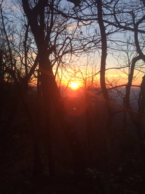
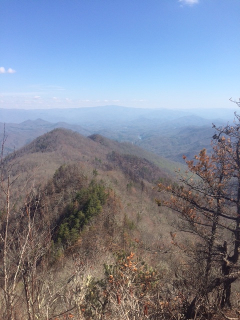
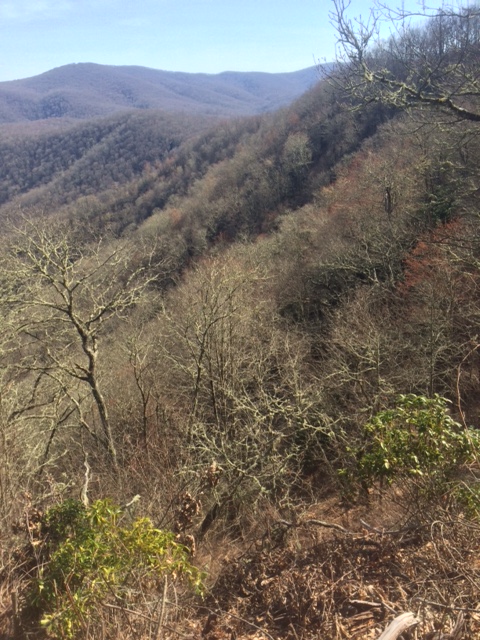
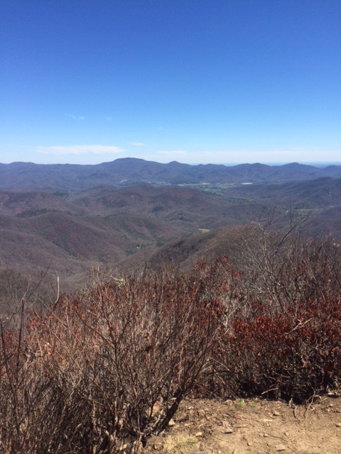
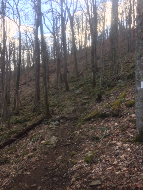
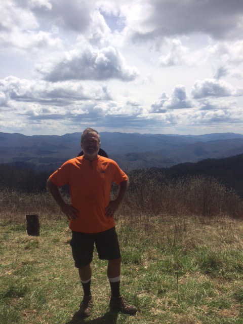
Big climb out of the NOC. Lasted almost all AM. Gained 3300 feet in 7.9 miles. This pic looks back on gorge that NOC is on.

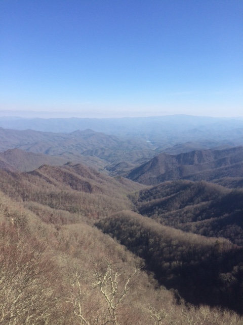
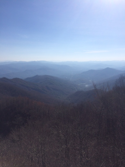
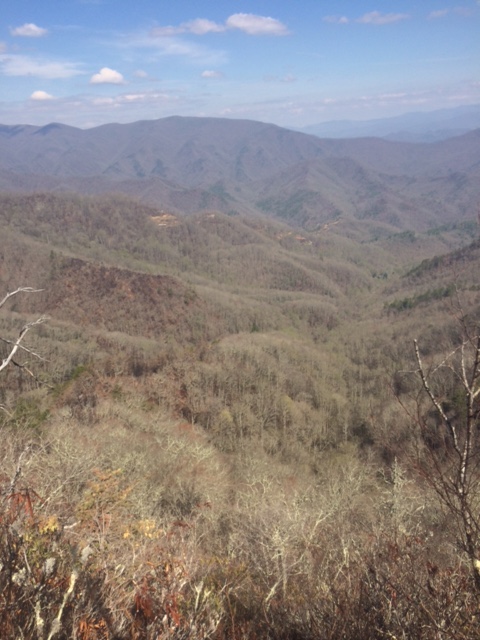
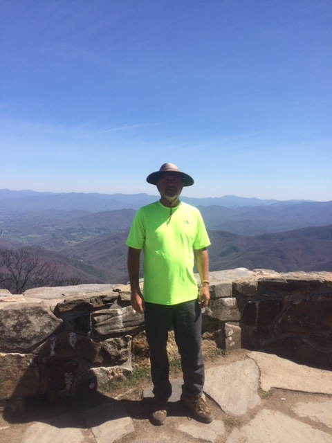
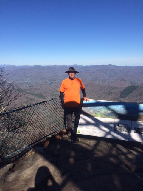
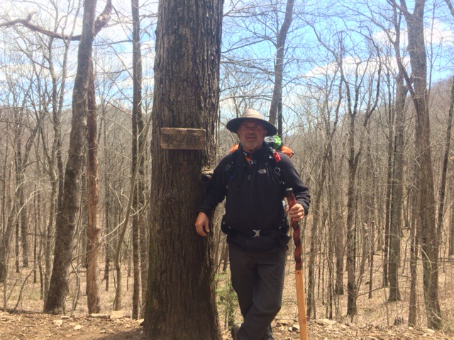
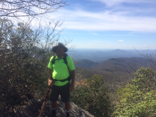
This is from Cheoah Bald. You can see a glimpse of Lake Fontana over my shoulder. Tomorrow’s destination.


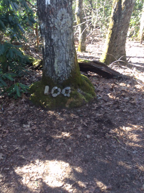
There are quite a few signs on Trail. This is by far the nicest. Most are very small telling you that you’re “here” or how far to “there”.

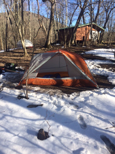
Was going to stop at Brown Fork Gap Shelter but pushed 2 miles further to Hogback Gap. Remote tent site. Thought I’d be by myself but a couple rolled in shortly after dark and tented near me.

That extra 2 mile hike will get me into Fontana an hour earlier in AM. Shower, bed, and laundry await!

Happy trails!

April 11

Day 12 Cold Spring Shelter to Nantahala Outdoor Center (11.7 miles)

Sunrise from my front porch this AM. Night was chilly but tolerable. This camping spot was up along ridge (4926 elev) as compared to most which are in valley. Nice views.

IMG_0377

This section has the worst fire damage I’ve been through yet. Lots of erosion causing trail to be quite narrow in spots.

IMG_0396

Next couple of pictures are from Weser Bald. In the distance you can see Lake Fontana. Hope to be there in 2 days!

IMG_0397

It amazes and impresses me that there is still so much wilderness in this country. I’ve been wandering through Nantahala National Forest for 2 days and there are wilderness areas as far as you can see. Support your National Parks, they are amazing.

IMG_0398

There is Lake Fontana again. This from The Jumpoff. Crazy name. If you jumped off, odds of death would be about 95%!

IMG_0399 (2)

IMG_0402

Arrived at NOC mid-afternoon. Huge recreation center (white water rafting, kayaking, fly fishing) that trail goes right through center of.

Had good dinner at River Edge Restaurant. One of top Trail restaurants. Lot of hikers.

Staying at a hostel here at the NOC. 9 bunk beds in 2 rooms. Got here late so I have a top bunk.

Next up, Fontana Dam in 2 days. Great Smokey Mountains after that.

Happy trails!

April 10

Day 11 Winding Stair Gap to Cold Spring Shelter (15.8 miles)

Caught shuttle back to trail and hiking by 9:30. Beautiful day. Sunny and about 60.

IMG_0363

Every once in awhile you cross Forest Service roads like below. Strange thing about this one is that was uphill to get to road and those stairs you see on other side are practically straight up too. Not what you want to see when getting to road!

IMG_0367

Below views are from Wayah Bald (elev 5342). Middle picture is Omaha Rick…in case anyone knows him, he’s alive and well.

IMG_0369IMG_0370IMG_0372

Met a guy heading south looking for his phone. Said had left pack 2 miles ahead, if I found phone just leave with pack. Didn’t find phone but did see pack with note. He ended up going back 4 miles to shelter he had stayed in and, amazingly, found phone.

IMG_0373IMG_0374 (1)IMG_0376

Made it to shelter area about 5. Nice spot for the night. Tomorrow about 12 miles to Nantahala Outdoor Center.

April 9

Day 10 Long Branch Shelter to Winding Stair Gap (7.2 miles)

A bit less cold last night (low 30’s?). Didn’t have to sleep in jacket, etc. so that’s good.

I’ve been pitching my tent in area near shelters (usually 3 walked building with platform on floor to sleep on). The areas have cleared pads for tents. Levels must not have been invented when pads were made. Very uneven. Have to shim my air pad I sleep on to keep from sliding off sometimes.

Got moving about 7:30AM. Huge motivator to know you’ll be getting a shower, laundry, and a bed at end of day.

Last week’s moisture seems to have springs and streams flowing well. They’ve been in drought conditions around here. Many places you can see remnants of wildfires from last fall.

IMG_0345

The trail is frequently narrow with a drop on one side or the other. If you would slip here you would probably roll until a tree stopped you. Only a couple spots where there has been a shear drop with nothing stopping a fall do a while.

IMG_0346

Some signs of spring at lower elevations. No clue what type of tree is budding here, but I thought it was cool!

IMG_0347

Finished my 7.2 miles at 11AM. At the point where that’s just getting warmed up!

2190 miles is too much for my mind to handle so I’m breaking the hike into 20 hikes of approximately 110 miles. Finished the first of those today. 109.5 miles down!

Lucked out again with ride when got to Gap. Jim picked me up and gave me a ride the 10 miles to Franklin, NC. Retired AT&T engineer (Purdue, Ozzy) who just likes to help hikers.

Congrats to Sergio Garcia on his Masters win. Was able to watch at Mulligans Sports Bar and Grill. Had a great time visiting with Trey (below). He even bought me a Bud. Thanks, Trey.

IMG_0362

Hoping to make it about 30 miles next 2 days to Nantahala Outdoor Center (NOC).

Happy trails!

April 8

Day 9 Standing Indian Shelter to Long Branch Shelter (16.3 miles)

It was a very cold night (guessing low 20’s) to be trying to sleep in a tent. Emphasis on trying. Wore all my clothes, plus jacket, stocking cap, and gloves, inside sleeping bag. Not a fun night.

Started walking by 9 and it was quite nice (warm) out by afternoon.

Most of the trail is a path that just goes up and down a lot. Every once in a while you have to hop across a stream or scramble on some rocks.


Below is Standing Indian Mtn (elev 5435). Think that’s the highest point to go over yet. Went from 4742 elev at Shelter this AM to here in first 1.5 mile of day. That will get blood flowing!


Mile 99.8 is Albert Mtn fire tower. It is a National Historical Landmark if you want to look it up. Last 0.3 mile to get here was 400 ft elevation gain. Brutal! Pulling myself up by rocks and trees.


The tall peak in center of below photo I believe is Standing Indian Mtn where I was 12.5 miles and 7 hrs ago.

In the next 3 photos, if you zoom in, you can see the trail winding through these hills. That is where I’ve been walking all afternoon.


Mile 100. Breaking out my happy dance!


Got to camp about 6:30. Should be a little warmer tonight. Peanut butter tortillas for dinner.

Easy (I hope) 7 mile hike tomorrow to Franklin, NC.

Happy Trails!

April 7

Day 8 Dicks Creek Gap to Standing Indian Skelter (16.7 miles)

Took shuttle back out to trail and was hiking at 9AM. Felt good to be moving again.  

It’s cold (low 30’s) and windy. First day I’ve hiked in a jacket. Gloves on too. One side of Mtn you can’t even feel wind. Other side, it about blows you over.

Made it to GA-NC border about 1:30PM. 1 state down, 13 more to go!


This tree is just into NC. Guessing it’s been here a while.


Little snow covering trail. Still from last night so hasn’t warmed too much today.  


Pitching my tent for night in snow! Building in background is shelter. Guess we’ll find out how warm my tent is!


Hope to hike another 16 miles tomorrow then easy 7 miles into Franklin, NC on Sunday.

Happy trails!

April 6

Day 7 Hiawasee, GA Zero Day

Spent the afternoon watching the Masters.

Ready to get rolling tomorrow AM. Feel all rested and a lot fresher legs. Supposed to be cold but that only matters at night (low 30’s Fri night).

Some random thoughts from a bored hiker:

It’s always nice to run into hikers you’ve seen before. You talk about where you started the day, where you are heading to, how much the last mtn sucked, and complain about any piece of gear you’re not happy with. I’ve got 2 guys I’ve run into several times: Alexander (Big Foot) a recent grad of U of NH. Played OG on football team. He makes me feel like a tortoise but we seem to end up in the same spots. Rick (from Omaha) is about my age. Here I’m the hare but, once again, we end up at same spots.

Backpack and walking stick are 2 items least likely to forget. It just feels weird to walk without pack. The walking stick (approx 95% of hikers use trekking poles) I notice within 10 steps if missing.

The shuttle driver I had Wednesday is an experienced thru-hiker. Said on a difficulty scale of 1 – 10, what I just finished is a 4. Buzz kill! I thought that was hard. From here through Smokie Mtns, he said is a 6. So, I got that going for me…which is nice!

April 5

Day 6 Hiawasee, GA Zero Day

It kind of stinks to hike 0 miles but the weather today has been rain with tornado watches. Glad I’m not out in that plus has been good rest for feet and legs.

Weather tomorrow is more rain plus getting colder. Chance of snow Th night/Fri AM. I’ve decided to take Th as a zero as well.

Will be able to watch opening round of Masters tomorrow. Plan to hit the trail Friday AM and reach Franklin, NC (about 40 miles) on Sunday in time to watch final round.

I have a big editorial correction to make. Randy? Is the Trail Angel who gave me the water on day 3. Problem is Randy? Is really John Baugus. My bad! Luckily I had given him my website info and he’s following my blog. Thanks again, John!

Today I made a reconnaissance mission to lone sports bar in Hiawasee to make sure it would be appropriate spot to watch Masters tomorrow. Got to watch Twins go to 2 – 0 plus met gentleman below.

Sandy will be 94 this month. WW 2 Vet who served in US Navy from 1942 – 47. Gets around great and sharp as a tack. Makes a 3 hr tour (still drives) every afternoon. 3 bars, 1 small beer in each. Fun to talk with.

IMG_0308

“Worst to First.
It was done in ’91.”

Go Twins!

Somebody please get me copyright, or whatever I need, for that one!

Happy trails!

Maryland Golf & Country Club

MGCC is located in Bel Air, MD. We lived near there and were members there from 2004 – 2011.

We (well, OK, mostly me) had some epic times there. We still have some great friends there.

They are showing their support through many pledges to the charities I’m hiking for and this unique tracking system (below). Wouldn’t be surprised if there are some games of chance also being played!

Thanks to everyone at MGCC for your support. I’ll see you in September for Member/Guest unless T-Ball fires me!!

April 4

Day 5 Unicoi Gap to Dicks Creek Gap (16.7 miles)

Caught a shuttle from Hiawasee to Unicoi Gap (where I finished yesterday). Before I left hotel I booked room for 2 more nights. Weather tomorrow is bad. Thursday not much better. I’m ready for a zero day. Legs are pretty dead after today’s long hike. Won’t hike tomorrow and will decide on Thursday sometime tomorrow. Hotels around here are packed as lots of people getting off trail.

Some of the people on my shuttle this AM pictured below. Note the big German dude in the kilt!

IMG_0297

This is the AT plaque at Unicoi Gap.

IMG_0298

Lot of steep ups and downs today. Probably why I’ll have a tough time getting out of bed tomorrow!

IMG_0300

This is from top of Rocky Mtn (elev 4017). That was a gain in elevation of 1100 feet in 1.4 miles. My exact thought while taking this pic “I hope the Trail doesn’t go over peak in distance”.

IMG_0301

This is from the top of Tray Mtn (elev 4430). 3 more mountains to cross then downhill to Dicks Gap.

IMG_0302

Finished hiking about 4:30. Hiawasee is about 11 miles from Dicks Gap and was going to try to hitch a ride but a shuttle driver pulled up right away and gave me ride for $10.

Looking forward to a day of rest for my feet and legs…and to watching storm from indoors vs tent!

Happy trails!