Day 15 Santander to Santillana Del Mar 26 miles (236 miles total)

Another really nice day mid-70’s and mostly sunny. 
It took a long time to get out of Santander. I was walking against the flow of people walking to work and I felt a bit like a pinball sometimes. 
These clouds scared me a bit at first. Looked like snow out on the mountain tops. 

I have no clue what the name of this river is but it was a major pain in my butt today. See those houses across the river?  I would walk on the other side of them 2 hours (and 6 miles) later. Frustrating!

When you walk by yourself for 8 straight hours with no music, podcast, etc., you have lots of conversations with yourself and sometimes animals. I really tried to encourage these sheep to take a short break from eating and enjoy the view. They did not respond which I guess is fortunate.

Got just little teaser views of ocean this afternoon. 

Every once in a while the towns and the setting are so scenic it almost looks fake. 

26 miles is a loong way. I don’t care what the terrain is like. After 20 miles my legs are pretty dead, my mind is pretty shot, and I’m pretty much staggering down the Camino. A bit scary when you’re walking down a road. 

After 8 hours of walking, I finally made it to Santillana del Mar. It’s billed as one of the most beautiful villages in Spain. Many movies are filmed here and it is filled with tourists. 

It seems to be a very old city but I had a difficult time finding a place to stay and the cobblestone streets hurt my feet so I wasn’t a huge fan. Could also have something to do with the fact that I was dead tired when I got there. 

Wind warning apparently in effect for tomorrow AM. Fortunately I plan on only 14 miles to Comillas which is a beach town known for caves, waves, and Gaudi. Sounds cool. 
Happy trails and buen Camino!

Day 14 Somo to Santander 4 miles (210 miles total)

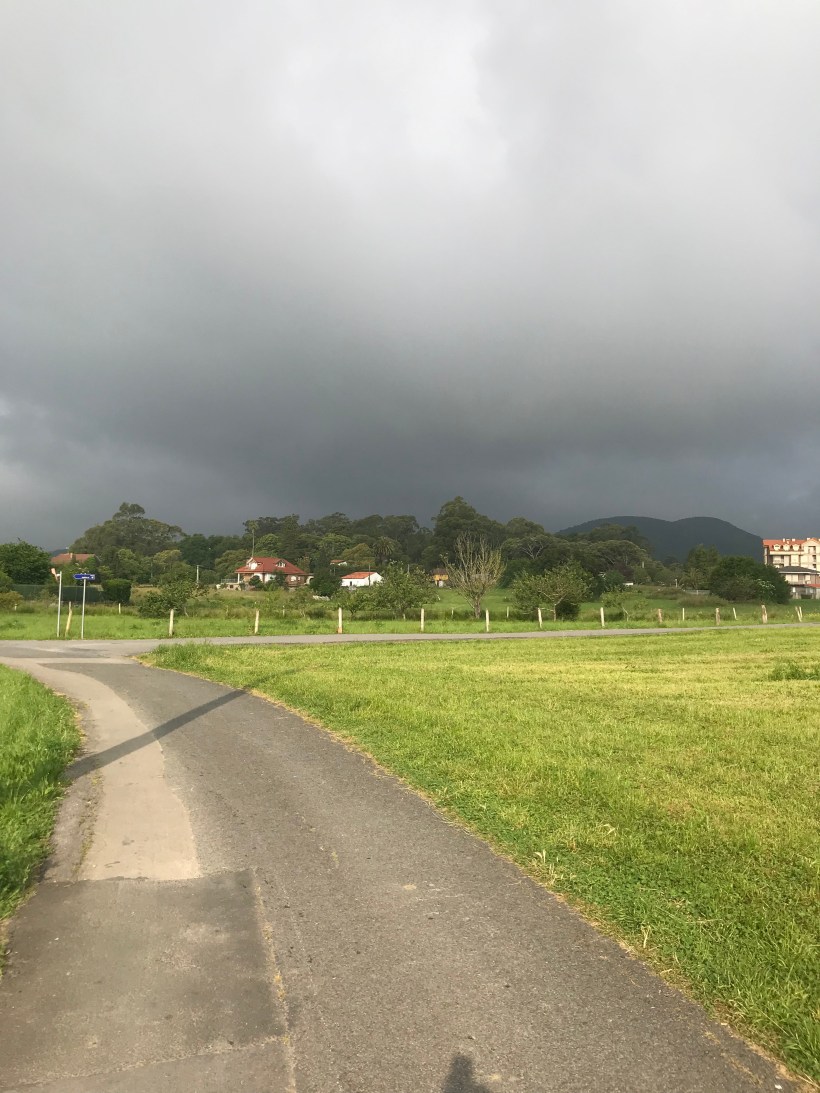
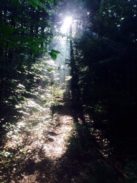
Today was a “nero” day. As in nearly zero miles. 
It was raining, windy, and cold in the morning. If you haven’t figured it out yet, I’m a fair weather hiker! 
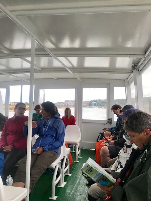
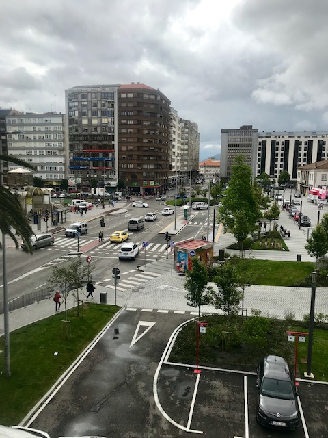
I basically walked out of Somo to a ferry stop, took the ferry across the bay to Santander and walked a ways through the city. 

The temperature today was in the mid-50’s. My planning for this trek did not factor these type of temps in. 
As I was killing time I decided to check out the latitude here and discovered it is basically the same as Toronto, Canada. Add in the fact that we’re next to a cold ocean and it starts to make sense. Probably should have looked into that a month ago. I would have brought a pair of long pants along!
Santander is a fairly big city with some interesting architecture. This is the Banco de Santander building. I found that interesting because, at one point, I owned some stock in that. Can’t remember how that worked out so that means probably not very good.

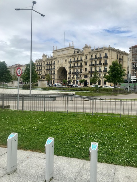
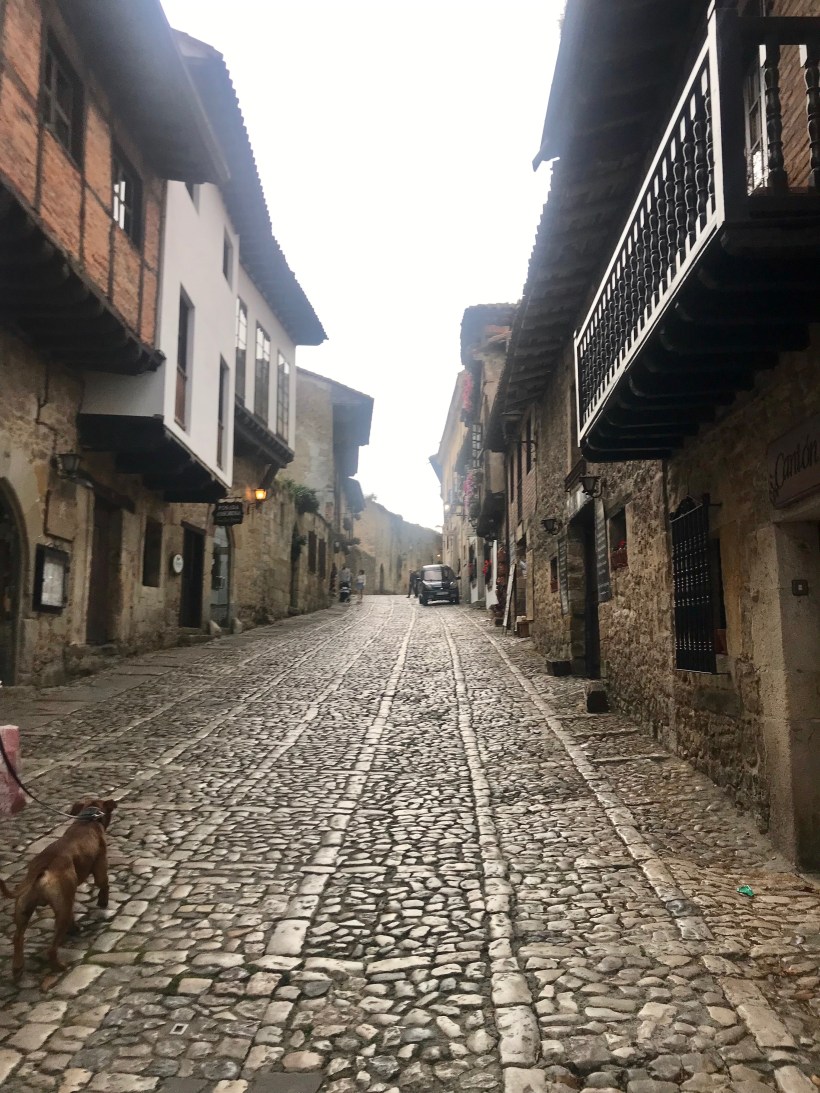
The Camino goes right down “Main Street”. 

By late afternoon, the wind was still blowing but sky was clearing up. Today was first time I recalled any real wind. 
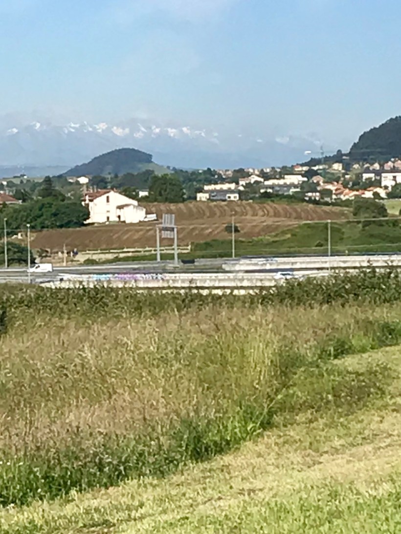
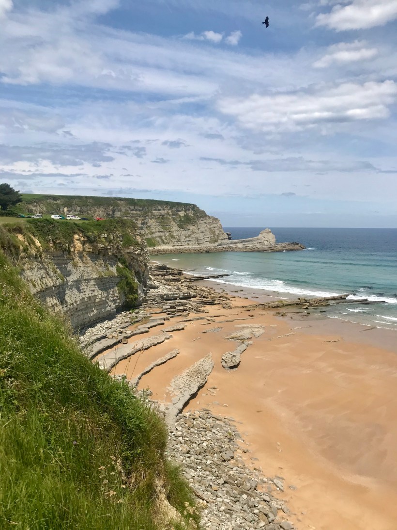
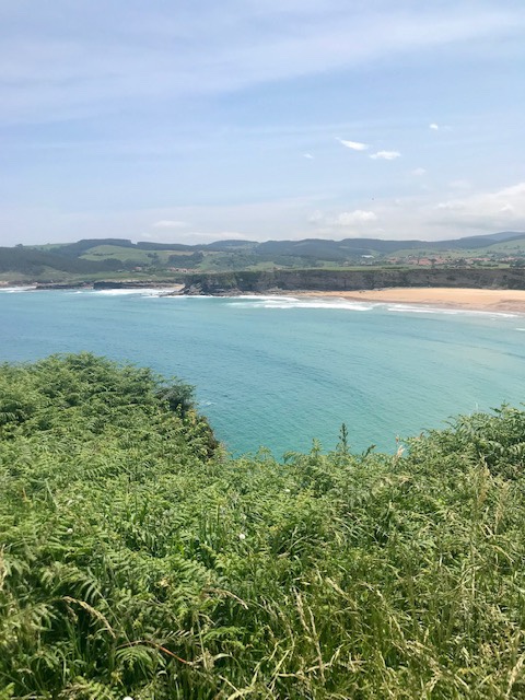
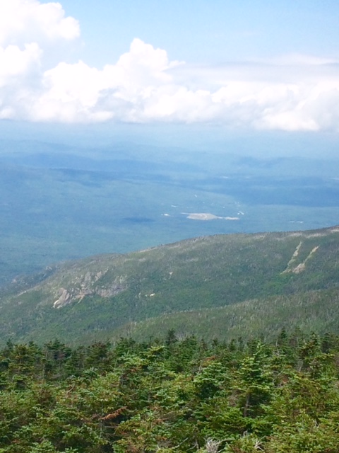
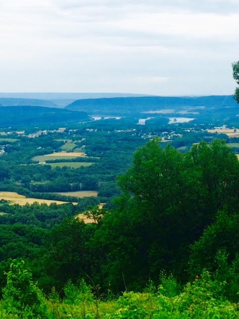
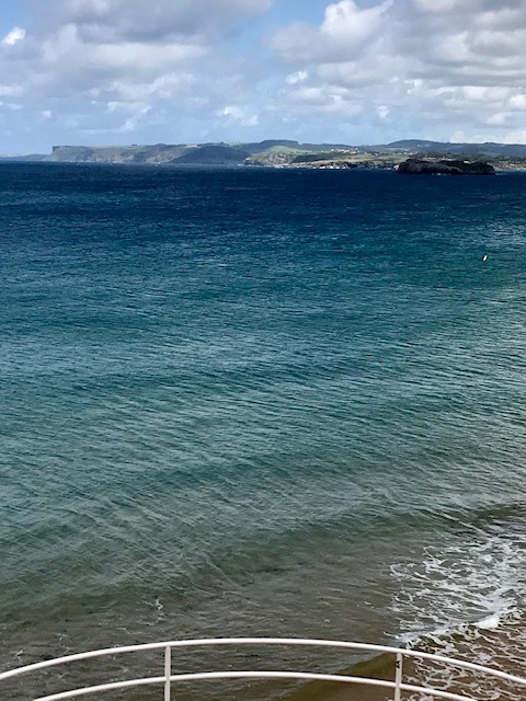
This picture looks back across the bay to the cliffs we walked along yesterday.

This whole latitude discovery helps explain another thing. Sun doesn’t set here until about 10PM
I thought about stopping in here and buying myself a fiddle but all they sell is clothes. Guess I could have gotten a pair of pants. 

I’ve covered 210 miles in 2 weeks. I hoped to do 100 miles/week so pretty much on pace.  I know now that I can really do 100 miles in 5 days and take 2 days off so I’ve got that going for me…which is nice. 
There is a path called the Camino Primitivo that splits off from the Camino del Norte somewhere up ahead. It sounds much more physically challenging. I’ve really done zero research on it as I just heard someone talk about it last night but my curiosity is peaked. 
The Camino del Norte eventually turns inland. If the Primitivo doesn’t force me to miss too much beach scenery, I may take it. Something to think about. 
Tomorrow’s weather sounds nice so I’ll be getting a move on in the morning. 
Happy trails and buen Camino!

Day 13 Noja to Somo 18 miles (206 miles total)

Thought I was going to be in for some rain today as I left Noja. 

The first 12 miles or so today was up and over some hills. Ended up not raining. I was happy about that but guessing the farmers not so much. Some of the fields look pretty dry. 
This corn won’t be knee high by the 4th of July!
John Deere green. She thinks his tractor’s sexy. 
If you don’t get it, you need a little country music in your life. 

I’ve seen thousands of this type of palm tree in my days. Never seen one with geraniums growing up the trunk. Love this look. 

And then for the last 5 or 6 miles we are back to the beach. That just doesn’t get old!

The Camino goes right along the top of these cliffs. 

Sometimes it’s good to take a look back and see where you came from. 

Sometimes it’s good to take a look back and see where you came from. 

Sometimes it’s good to take a look back and see where you came from. 

Our destination is that long stretch of sandy beach ahead and the surf town of Somo. 

Spent some time with a couple salty locals.

Happy trails and buen Camino!

Charities Update

Brooke and I, well mostly Brooke, have been doing some updates to http://www.at-pete.com.

I’m happy and proud to let you know that we will be raising money for the 3 charities (Sun Dial Manor, K-9’s for Warriors, and the Down Syndrome Program at Boston Children’s Hospital) we raised a total of $67,000 for on the AT. You can read more about those charities at https://at-pete.com/2017/03/16/charities/. When you are ready to pledge, go to https://at-pete.com/pledge-information/. We’re open for business!

I have also loaded my planned route and some maps on the Camino de Santiago page and updated the Appalachian Trail page with some lessons learned and photos. I’m going to lessen the quantity of pics but I haven’t quite figured that out! Bear with me.

Once I start walking (about 5/23), I’ll try to blog daily and hope you enjoy following along. Feel free to get your friends and family following.

Let’s do some good things for some good causes again!

P.S. Pushup challenge update. I’m at 48 as of 5/10. Unfortunately on attempt for the 49th I twisted a muscle or pinched a nerve. I’m afraid to try again unless I feel 100% recovered by the time I leave on 5/20. I may fall a little short. Kris, on the other hand, is about 50% over her goal. She kicked my butt!

August 16

Day 139 No Pond Tentsite to Mitzpah Spring Hut (8.7 miles) 1850.8 miles total
That was a hard 8.7 miles.

Walked along Webster Cliffs. Great views but wind was 40mph+.


I usually don’t get passed by too many people in a day. Young day hikers were flying by me. Probably passed by 20!


There was a lot of rock climbing today. Had to toss stick up ahead couple times because needed both hands. Lots of stretches like below and then, of course, you have to go down similar. I’ve learned to swallow my pride and scoot down on my butt at some points.


That little dot in center of pic is the Hut. Finally got there at 2:30.


Ran into Alexander (Big Foot) who took pic of family on day 1. Haven’t seen him since Hot Springs, NC. Long time ago!

View of dining area and kitchen behind.


Great dinner: bean soup, bread, salad, pulled pork, baked broccoli, and blueberry bars for dessert. I pigged out.


Weather tomorrow is supposed to be good. Almost 6 miles to Mt Washington. Hope to be there by noon. Hoping to make 15 miles total.

Happy trails!

August 15

Day 138 Mt Garfield Tentsite to No Pond Tentsite (15.5 miles) 1842.1 miles total

Long day but got myself 8.7 miles from Mitzpah Spring Hut. Hope to roll in there about 2PM tomorrow as a guest!

FullSizeRender

It was a short hike to Galehead Hut. Not as spacious as previous Hut. They did have soup (more like broth) and baked goods (burnt) and it was nice to sit and rest a bit.

This is my artistic impression of Hut. Retro Western saloon look with backpacks up front instead of horses.

FullSizeRender1

They do have a pretty nice view from that front porch.

image1 (4)

Scaled South Twin Mtn (4902′). You can see some relatively flat land in this direction.


FullSizeRender3

Of course, I’m heading in this direction!

FullSizeRender4

The muck from bog fall has pretty much worn into shirt. Have been able to rinse off a bit at Huts.

Below is an example of boggy muck. No boardwalk where I fell. Just imagine rocks that you hop/step from one to the next. Closest crap is like quicksand that is about 8″ deep. After that it’s a little more liquid and a couple inches deeper.

image2 (2)

Stopped at Zealand Falls Hut later (4PM) in day. They were very busy with guests checking in, including about 30 Boy Scouts. Asked Croo if I could pay to fill one of my liter water bottles with lemonade. “Sure. Just leave what you think it’s worth in box.” Guessing to normal person would be worth about $5. To me, at that moment, about $20. I left $5.


FullSizeRender5

5 miles from Hut to Ethan Pond Campsite where hoping to tent. First stretch in Whites where you could move relatively quickly.

Made it in less than 2 hours only to find all tentsites taken. They have a caretaker here and charge $8 per person to tent. I’ve just hiked 15+ miles through Whites (plus 1/4 to campsite) and I’m not happy! Caretaker told me about spot less than half mile up trail. Thus, I end up at No Pond Tentsite. Good, level spot at least.

Excited to spend tomorrow night at Mitzpah Spring Hut. Just have to cross Mt Webster and Mt Jackson to get there.

Happy trails!

August 14

Day 137 Lonesome Tentsite to Mt Garfield Tentsite (13.3 miles) 1826.6 miles total

Hard but really amazing day of hiking.

Stopped by Lonesome Lake Hut about 9AM. Talk about exceeding expectations. Amazing.

This is right on trail. Front door to kitchen/dining room. There were also 2 bunkhouses.

FullSizeRender

Below is dining area. During day they sell baked goods ($2), coffee, lemonade ($1) to hikers.

FullSizeRender1

This is kitchen area. Hikers can also get water and there’s a bathroom. They also have bowls of soup for sale. I was a bit early for that.

FullSizeRender2

I’ll be a guest at Mitzpah Spring Hut on Wed. Member of the Croo (full-time employee at Hut) told me a thru-hiker who stays as a guest has the ultimate time. “Get there early.”

This is Lonesome Lake. 50 yds from Hut with a dock and seating area. 2 older guys sitting there watching a family of ducks swim by. One guy says to other “I wonder what the lifespan of a duck is.” From behind I said “Where I come from it’s until they get shot.” These guys did not think funny! Gave me dirty stares. I thought it was hilarious!

image1 (3)

The other good thing that happened at Hut is another Croo member told me that I’m through the worst of Whites. “There’s some as bad but nothing worse.” That put a little spring in my step!

This is from Little Haystack Mtn looking up to Mt Lincoln. Yeah, we’re going there.


FullSizeRender4

Mt Lincoln looking up to Mt Lafayette. Going there too.

IMG_1299

These last 3 peaks are all above tree line. Views are spectacular.

This is looking back to Lonesome Lake. 9.5 miles of tough but rewarding hiking.

image2 (1)image3 (1)

This is view from Mt Garfield (tenting 20 yds from there) back at Mt Lafayette.

Tomorrow will cross South Twin Mtn (4902′) and Mt Guyot (4580′). Also will go by 2 Huts!

Happy trails!

August 11

Day 134 NH 25 to Kinsman Notch (9.3 miles) 1800.4 miles total
Strong thunderstorm last night. Rained pretty hard for a bit.

Walking toward the light.


Wicked hard climb to top of Mt Mooslauke. As hard to climb as spell! 3800 ft up in 5.5 miles. That’s climbing. There was no down…all up.

First above tree line action.


Got a bit cool and windy on top.

Dartmouth Outdoor Club maintains this section of trail. They win the prize for nicest signs.


Once again wishing I knew what peaks I”m looking at. There should be an app for that!


The descent was 2500 ft in 3.8 miles. I go almost as fast uphill as down because I don’t fall (so far) going up.


This down was nasty. Very wet and rocky. Not a good combo. Slipped and fell on my butt 6 times. Tweaked my left knee and bruised my ego. Discovering my slow gear doesn’t work well.

Hiked down beside water I pic below. Started as a trickle. Waterfall most of way down. Ended up as river at bottom.


Finally made it down alive. Got picked up very quickly by Scott and Leslie, a really nice couple from coastal Maine up doing some hiking.

Drove me right to hotel. While getting my stuff out, I realized didn’t have my walking stick. I get comments daily on the stick. Kind of my identity. Just today guy said he’d heard about hiker with nice stick…me!

Scott asked how long I’d had stick. Told him every mile. “Get in and let’s go get it”. Drove 5 miles back up Mtn. Stick was sitting against post, right where I had set it. Thanks so much, Scott and Leslie!

Not sure about tomorrow. Knee is pretty sore right now. Stiffened up as evening went on. Have I told you falling sucks?!!

Happy trails!

June 30

Day 92 Wind Gap, PA Zero Day 1278.1 miles total

Healing up. Arm feels better today. Discovered another pain spot when that subsided. My side/ribs must have gotten “rocked” as well. Feel like I took a Logan Storley punch in the ribs.

Brooke made it up to the lake in time to go out with our friend Dave for fireworks on the lake. It rained, of course, but we were able to see fireworks going off all around lake.

Going to take tomorrow off as well. Rain in forecast, still sore, Brooke is here, dog ate my homework. I’ve got plenty of excuses!

Will get the show back on the road Sunday!

Happy trails!

June 21

Day 83 Big Rock Campsite to Rock Chairs Campsite (12.3 miles) 1168.2 miles total

Naked Hiking Day was either a ruse or a myth. I didn’t see one other naked person the whole day. Felt like I was at a party and I was the only one who thought it was a costume party!

Just kidding…I remain clothed so as not to scare anyone.

unnamed

PA is lovingly referred to as Rocksylvania by hikers. Very proper.

unnamed (1)

I stopped short of where I was planning to get today. Came across a campsite that has chairs (with backs) made from rocks. Comfortable and a great use of rocks!

unnamed (2)

Will try to make Lickdale or Pine Grove, PA today. Hopefully.

Happy trails!