May 26

Day 57 Three Ridges Mtn to US 250 (22.9 miles) 861.9 miles total 

Good weather day. Partly sunny and in the 70’s. Makes for nice hiking and good miles.

Ran my phone out of battery today. Have a small portable charger that I did not get fully charged at last stop.

Made it to Waynesboro, VA this afternoon. New shoes were waiting!

Tomorrow I will start hiking through Shenandoah National Park. Been looking forward to that as trail follows ridge line near Skyline Drive. A few restaurants very near trail and relatively easy hiking (supposedly).

Happy trails!

May 25

Day 56 Hog Gap Camp to Three Ridges Mtn (25.2 miles) 838.2 miles total

Today there was a bright spheroid in the sky. It seemed to provide some warmth. Talked to a wise, old man who told me they call it sun. I like sun!

Good day. Weather and terrain wise. Able to make up for some “lost” miles.

In VA I’ve walked through Thomas Jefferson National Forest and am now in George Washington National Forest very near Lexington, Va, the birthplace of Robert E. Lee. The history, and the people who probably crossed where I’m hiking, fills me with a sense of awe.


Need to make nearly 24 miles to Waynesboro, VA tomorrow. New shoes waiting for me!

Happy trails!

May 24

Day 55 Punchbowl Overlook to Hog Camp Gap (17.2 miles) 813.0 miles total

Walked through lots of fog again today but at least made some progress.

Took a slip on a wet rock. Ended up with scraped elbow and cut up thumb. This just a day after telling Kris I had used no bandages so far. Jinxed myself!

FullSizeRender (99)

Weather started to get colder mid-afternoon and started raining about 3PM. Decided to make camp before too cold and wet.

FullSizeRender (100)

Rain forecast for all night. Supposed to stop in AM then rain again late afternoon.

Happy trails!

May 23

Day 54 Buena Vista, VA Zero Day 795.8 miles total

This is getting frustrating!

Shuttle to trail scheduled for 9AM today. Woke up to view of mountains below. Light drizzle and low clouds.

FullSizeRender (98)

Was prepared to walk in that but started raining harder right before shuttle arrived. As forecast for afternoon was for steady rain, I canceled hiking plans for day.

Got to Post Office and sent back fleece jacket and stove. Just taking up space in pack.

Afternoon showers tomorrow and Th PM in forecast. Going a little stir crazy so hoping decent weather in AM.

Happy trails!

May 22

Day 53 Petites Gap to Punchbowl Mtn Overlook (20.8 miles) 795.8 miles total

Mostly cloudy but no rain today.  Southern VA has gotten 5.5″ of rain so far in May.  Looking at 2 more inches over next 3 days.  Probable flooding in areas south of where I am.  Hoping just rains at night.  Got miles to make!

FullSizeRender (95)

This is the James River footbridge. Longest foot-use-only bridge on AT. Just before crossing was a lady doing some volunteer trail maintenance (whacking weeds with a scythe). She offered me some watermelon. Refreshing!

FullSizeRender (96)

Looking back down at James River and area of footbridge.

FullSizeRender (97)

View from Big Rocky Row after 2000 ft elevation gain in 3 miles. That’s steep and generated a lot of sweat.

IMG_0703

Hitched a ride into Buena Vista, VA at end of day. Expecting rain tonight (again).

Next stop Waynesboro, VA. Will have some new shoes waiting for me there. My Merrill Moabs have been great but 800 miles is a lot of steps! Starting to come apart. Hope Krazy Glue holds or I’ll have some wet feet next few days.

Happy trails!

May 21

Day 52 VA 614 to Petites Gap (18.7 miles) 775.0 miles total

Cloudy and very foggy today. Not a good day for photos.

Some hikers have packages of food sent to them along the trail. Unnecessary in my opinion (unless you are on a special diet) as you can resupply every 2 to 3 days.

Package below was sent to campground I stayed at last night. It was taken from the mailbox and opened by a bear. Three other packages went missing this week as well. I imagine bear saying “Where is the mail? It’s 3:00. Should have been here by now.”

FullSizeRender (94)

Big jug to right is strawberry wine fermenting.

Started raining about 7PM. I was in tent already so dry and cozy.

Weather for tomorrow is same. Cloudy with shower possibilities increasing later in day. Hoping to make 20 miles to Buena Vista, VA.

Happy trails!

May 20

Day 51 Bearwallow Gap to VA 614 (5.6 miles) 756.3 miles total

I felt a little lethargic this AM but got on trail by 9:30.

Saw a fisherman catch a big trout in this stream. Probably close to 24″. Also saw a big, brown snake swimming along. Probably close to 48″!

Shuttle driver said to me this AM “Be careful up there today. It’s gonna storm up there this afternoon.”

When you’re hiking in forested mountains you don’t see much horizon so difficult to see storms approaching. I heard yesterday’s thunderstorm much earlier than I saw clouds.

I knew leaving that a campground (with lunch) was 6 miles down trail and a shelter at 10 miles. If it was like yesterday, there’d be a passing thunderstorm then clearing.

Got to campground little after noon. Not raining but I was actually hoping it would start so I could justify not hiking and getting a cabin.

About 1:30 clouds started moving fast. I got a cabin. By 3:00 major thunderstorm. Made me feel vindicated and not such a slacker!

Rained pretty good for about 4 hrs. Electricity went out. My cabin (no running water) was dry though.


Weather for next 5 days is very similar so will do what I can to make some miles.

Happy trails!

May 19

Day 50 US 220 to Bearwallow Gap (21.6 miles) 749.7 miles total

Warm and humid this AM. Beats cold and rainy! Did have about an hour long thunderstorm that cooled things down a bit. I was close to a shelter midway through the rain so was able to stay mostly dry.

The trail crosses the Blue Ridge Pkwy numerous times through here.


Hiking was fairly easy today as not a lot of big elevation changes.


We’ll be heading to that big peak tomorrow.


Got to Bearwallow Gap about 5:30. No cell service to call for shuttle. Had to hitchhike the 5 miles to Buchanan, VA. Not a lot of traffic but got ride after about half hour.

Off and on rain for next 3 days. Hopefully mostly off!

Happy trails!

May 17

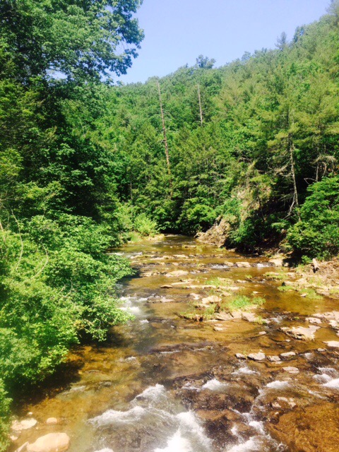
Day 48 Pickle Branch Shelter to Pig Farm Campsite (16.9 miles) 712.6 miles total

Not a lot of miles but some rewarding ones. Two big climbs of 1000 ft+ over 2 miles. That will test your lung capacity!

Grock (experienced hiker) also told me the other day that I would get faster as my trail reading skills got better. Chuckled to myself as I thought “How hard can trail reading be? Even I haven’t made any costly wrong turns.”

Well…happened twice today! Cost me about an hour and a half of time. One was bad. Climbing down this gully slipping, sliding, and thinking a lot of people must get hurt here. Ten minutes down and I knew it couldn’t be trail. Took me 30 minutes to climb back up.

FullSizeRender (88)

I think we all know where this is going. Right up and over that hill. Nice hiking through non-forested land, even when uphill, because no roots and few rocks.

FullSizeRender (89)

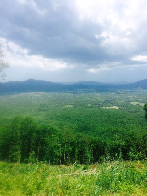
McAfee Knob. Probably 20 day hikers and 1 thru-hiker there when I arrived. Day hikers scattered when I went out on Knob. Not sure if it was beard, stench, or the fact that I looked like I had just hiked all day to get there.

Just Rocky…King of the Knob!

FullSizeRender (90)

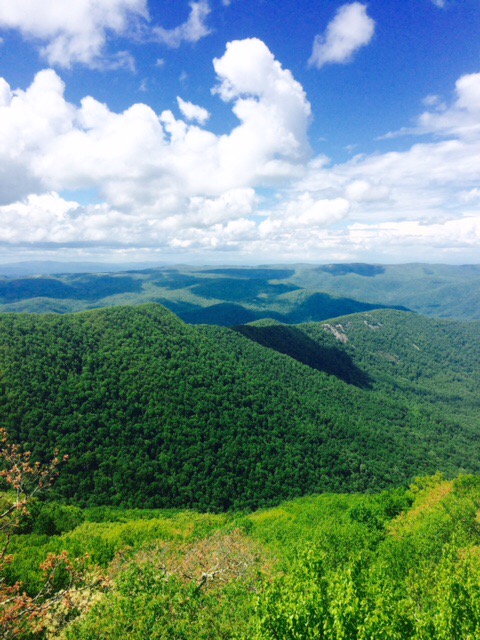
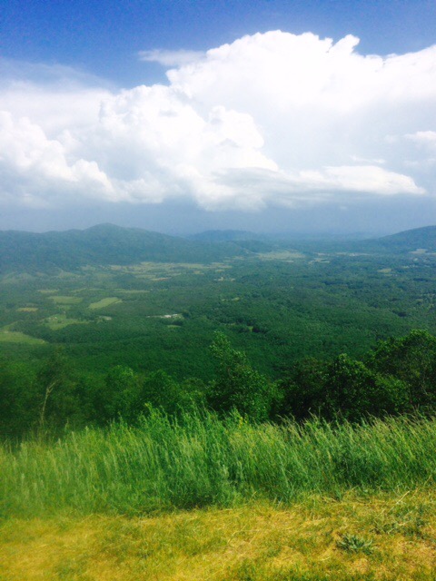
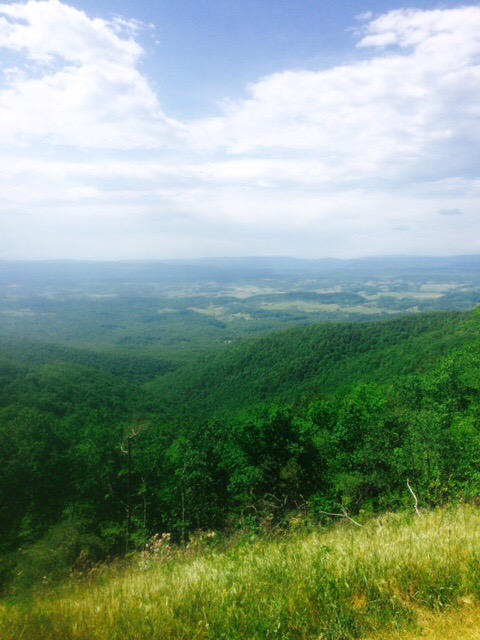
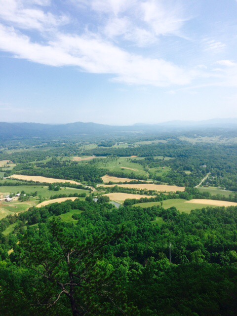
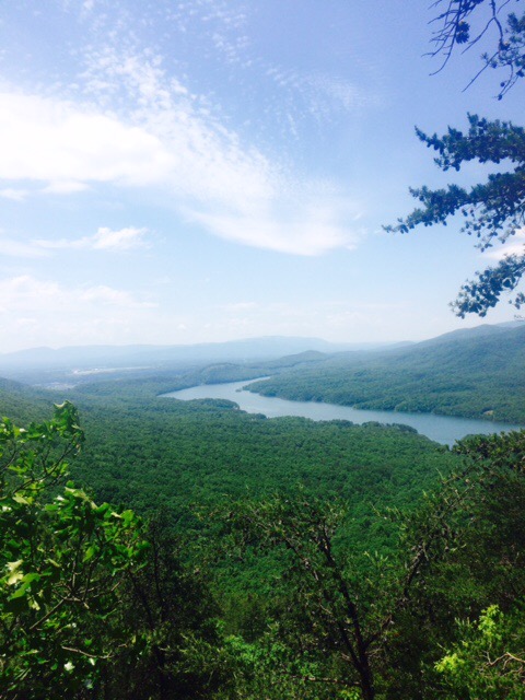
Panoramic view from McAfee Knob. Better, Legs?

FullSizeRender (91)

15.5 miles left to Daleville, VA. If I feel good and weather is good, I will just stop and get something to eat and go another couple hours further. If not I’ll stay at motel in town.

Happy trails!