July 26

Day 118 Dalton, MA to Wilbur Clearing Shelter (20.5 miles) 1589.2 miles total

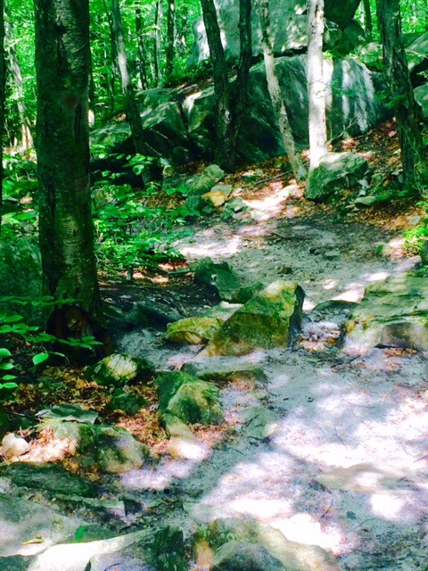
Pretty good hike today. Starting to be at higher elevations and fewer rocks. Terrain is getting more similar to beginning of trail (switchback climbs). Much better than the ups, downs, rocks, etc. of last 500 miles.

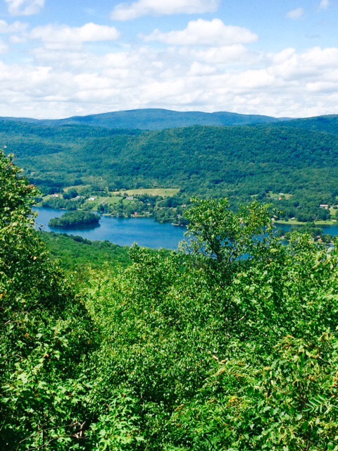
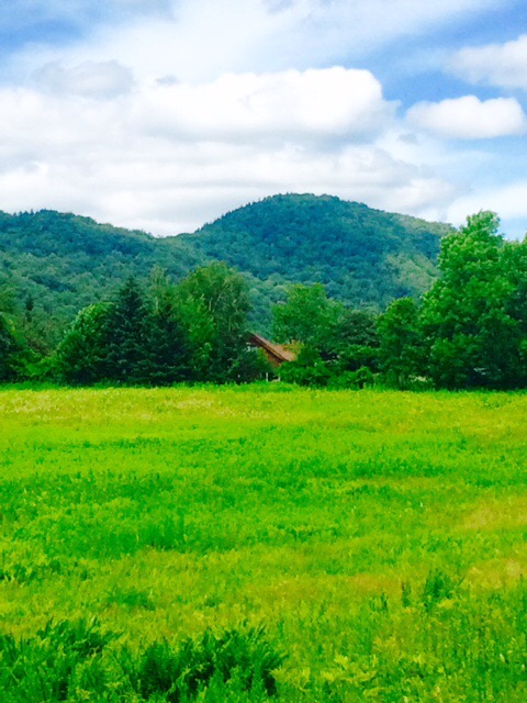
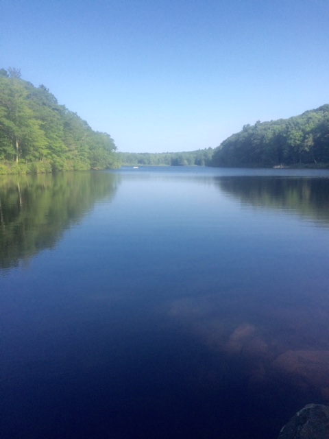
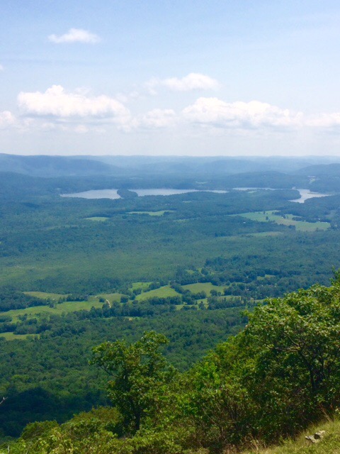
This view is the Hoosic River Valley and the town of Cheshire, MA.

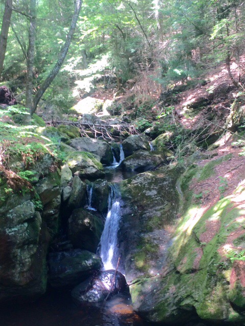
Trail is sandy for a ways in this area. First time I’ve seen that.

Cheshire is on the trail and one of first places you come to is a little sandwich and ice cream shop. Perfect! One problem…it’s cash only and I only have $11.25. Had to spend wisely. Got grilled cheese, 2 cans of Mountain Dew, and a large chocolate cone for $11.

While sitting on picnic table there, a young kid came up to me and asked if I would sign his notebook. His name is Snowbird. He’s 10 and trying to get as many hikers as he can to sign. Kid knows a lot about the trail.

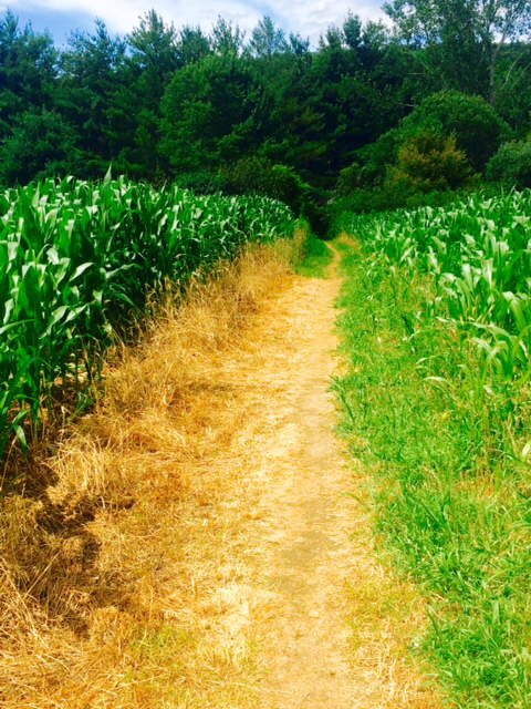
Leaving Cheshire through the cornfield.

Most places I stop the locals will think the trail around their area is really tough. I usually let that go in one ear and out the other except for last night…

Guy at bar asked me how far I was going to hike today. Hadn’t really thought about that yet but said “somewhere around Mt Greylock”. Dalton is about 18 miles from Mt Greylock, the highest point in MA at 3491 ft.

He doubted that I could get that far as it’s “an 8 mile ascent up to there”. I had an objective!

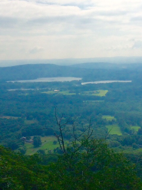
I believe this is Mt Greylock below.

He was right about the 8 mile ascent. However you only ascend 2500 ft. 4000 ft in that distance would have gotten my attention.

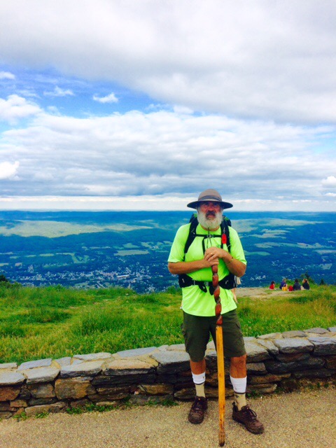
Made it. Was actually a nice hike.

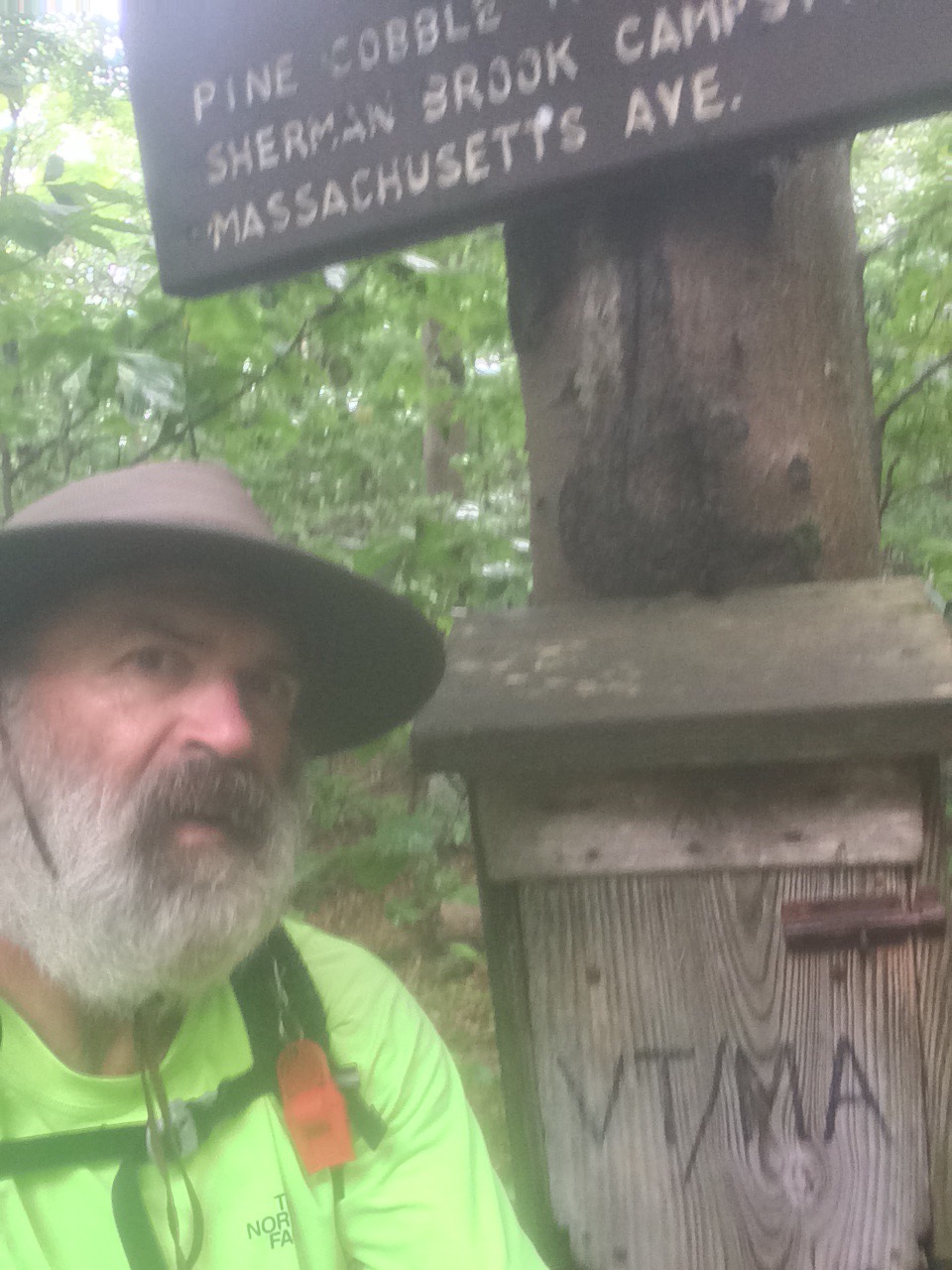
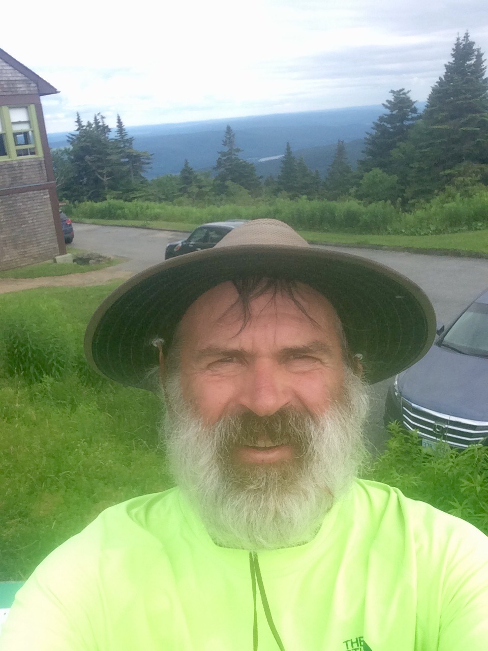
Little selfie update of the beard.

Top of Mt Greylock.

Supposed to rain most of day tomorrow. I am in a spot where possible to reach Bennington, VT in a day if need be (21 miles). Hoping to get as close as I can tomorrow and get there Friday AM.

Happy trails!

July 25

Day 117 October Mountain Shelter to Dalton, MA (11.8 miles) 1568.7 miles total.

Cool and a few sprinkles today. Pretty good day for hiking.

Spending most of the time on ridge lines so hiking is fairly easy but views are limited.

FullSizeRender

Trail goes right through Dalton. Seems like a nice town. If you zoom in on photo below you will see AT sign hanging on porch of house.

FullSizeRender1

Factoid of day: Dalton is the home of Crane Paper. Crane makes paper and is the supplier of all paper currency for the US and some other countries. They make the paper and ship it (under armed guard) to various mints for printing.

Next stop is Bennington, VT. 42 miles so hope to be there Friday.

Happy trails!

July 24

Day 116 Main Rd to October Mountain Shelter (15.7 miles) 1556.9 miles total

Had a rain delay this morning. Rainy, windy, and chilly (low 50’s) early. I stayed at motel until they threw me out at 11:00. They didn’t actually kick me out but wouldn’t give me a late checkout. One of least “hiker friendly” places I’ve stayed.

No Uber so taxi’d back to Tyringham. Hiked in light rain for first hour or 2. Had to wear a jacket for first time in a while. Not supposed to get up to 60 today and intermittently strong wind.

FullSizeRender

Not many photo ops today. Most of the time in rain, fog, forest, or all of the above.

Have about 12 miles to Dalton tomorrow. Trail goes right through town…which is nice!

Happy trails!


July 23

Day 115 Beartown State Forest to Main Rd, Tyringham, MA (11.3 miles) 1541.2 miles total

The last thing I do before packing up my tent each morning is review next water source, resupply point, and town stay.

This morning I realized that I would be 5 miles from Lee, MA. Was planning on being in Lee on Monday but I’ll be just as close today and can probably make it for end of British Open. Hike on!

Below is Benedict Pond which I tented near last night.

FullSizeRender

Entering the Berkshire Mountains. They run through MA. Cool old farmstead up on hill.

FullSizeRender1

Entrepreneurship at it’s finest. This stand is about 100 yds off trail. Sodas, snacks, charging station. All on the honor system!

FullSizeRender2

Made it to Tyringham about 12:30. Unfortunately had a difficult time getting ride into Lee and didn’t get to hotel until after 2:00. Missed end of Open but got to shower and do laundry!

Two days and I should be in Dalton, MA.

Happy trails!

July 22

Day 114 Race Brook Falls Campsite to Beartown State Forest (20.1 miles) 1530.9 miles total

Bill Belichick would probably have me listed as Doubtful (shoulder) on the injury report but knee and leg are about 95%. Had to throw the Pats thing in there since I’m in MA!

Bet it took a while and a lot of work to clear those fields from the forest. I’ve seen a couple pastures with sheep, lots of hay land and some corn in those clear areas.

Some times it’s just a walk in the woods.


Water sources have been sketchy (but getting better) for a while. Since beginning of NY there have been several places where Trail Angels will leave jugs of water like this. Added bonus if it’s still cold!


Sometimes I imagine characters while I’m hiking. Keeps the mind occupied. Today I was a Revolutionary War soldier scouting the forests of western MA.

Apparently my character was too early for Shays Rebellion but the last battle was fought here.


I pushed a couple extra miles because was told Greater Barrington, MA was having their 5th annual AT Appreciation Picnic. Free food and hikers are invited.  

There is a lot of volunteer time and labor that goes in to maintaining the trail. This was a gathering of those groups and all their families.

Live music was provided by the Berkshire Ukulele Band. They were quite good and had the audience singing along.


There were about 10 thru-hikers and we were the featured guests. Front of the line privilege for food, incredible raspberry, blackberry, blueberry crisp with ice cream (served to us as appetizer and desert!) and as much food as you can imagine.


Well worth the extra couple miles. Tented right near the picnic.

Next stop is Lee, MA. It’s 20 miles. Will probably hike 13-15 tomorrow and get in early Monday.

Happy trails!

July 21

Day 113 Falls Village, CT to Race Brook Falls Campsite (18.5 miles) 1510.8 miles total

Leg is feeling much better. Very little inflammation and redness has ebbed some…I’m pretty sure. Hard to tell with tan, hair, etc. Was easy to differentiate red area before so I’m assuming that’s good!

Had a view of this body of water for a long time today. This is from Bear Mtn (elevation 2316). First time above 2000 ft since VA.

Pretty sure trail won’t go below 1000 ft again. This is Sages Ravine.


Cross CT off. We’re now in Massachusetts! 9 states down. 4 to go. Yes they’re all more mountainous and more difficult but there’s only 4!


Here’s that body of water again. I’m on Mt Race about 3 miles into MA and looking to east. If any of Mrs. Johnson’s 6th graders from Groton, SD are following this summer, please let me know name of it.


There are some giant spiders out here in the woods. As I type this (on my phone with one finger) one who has about 6″ leg span is walking over outside of tent. I’ve had as many as 8 on tent at once. If you suffer from arachnophobia do not do this.

Hoping for another good mileage day tomorrow.

Happy trails!

July 20

Day 112 Mt Easter Rd to Falls Village, CT (7.1 miles) 1492.3 miles total

Bit less inflammation in leg today. Knee also less sore. Redness has not expanded but I can’t say that it’s decreased yet.

FullSizeRender

Made a few miles of progress in AM. Spent the afternoon watching British Open. Rooting for Matt Kuchar. His parents live in our hood in Ponte Vedra Beach. Go Kuch!

Hoping to get back to making miles tomorrow. Less than 700 to go.

Happy trails!

July 19

Day 111 CT 4 to Mt Easter Rd (6.8 miles) 1485.2 miles total

After about 2.5 hours of hiking I stopped at a road crossing to check my leg as soreness now in knee and thigh. More redness. Decided to try to hitch a ride 5 miles to Sharon, CT where there is a hospital.

Started walking toward town. Road was not busy so thinking I may have to walk entire way. After about a mile a local guy, Dave, picked me up. Drove me straight to Emergency Room.

RN took one look at leg and said “Classic bullseye. You have Lyme Disease.”

After a bit, PA came in with student. “Hear you have a classic bullseye.” I replied that I’ve never seen a “classic bullseye” but this isn’t what I would expect a bullseye to look like. Not round and kind of meandering.

After questions around symptoms and some further examination, she concluded that it’s either Lyme or cellulitis. That made me bristle and I said “I don’t have any cellulite!” She explained that cellulitis is actually a skin infection. I’ve got quite a few cuts and scrapes which could lead to that.

They took blood to test but won’t have results for 3 days so she prescribed an antibiotic that will treat both Lyme and Cellulitis. Drew a line around redness. Quite a large area.

They want me to stay around here tomorrow to make sure redness doesn’t spread beyond drawing.

Had a phone number for a B&B in Salisbury. Maria had a room available. Asked where I was. When I told her hospital, she said she’d come pick me up.

Maria is 88 and super nice. She took me to pharmacy and when we got to her house told me to shower then call my wife and mom!

I am actually kind of hoping that test comes back positive for Lyme Disease as would explain general sense of lethargy I’ve felt for last week.

Planning on walking a bit tomorrow and staying another night at Maria’s.

Happy trails!

July 17

Day 109 Schaghticoke Mtn Campsite to CT 4, Cornwall Bridge, CT (14.3 miles) 1478.4 miles total

One thing I should know about this trek by now is that planning is a waste of time. Too many variables (namely weather and injury) that I have no control over.

Was hoping for a few more miles today but humidity has returned and I lost one of my water bottles somewhere.

FullSizeRender

I’m also dealing with some kind of insect bite (I think) around my left knee. Noticed redness on Th but no pain. Redness has spread a little and now some swelling and knee is sore.

Going to take a zero today to see if that helps knee. If not, may have to try to figure out where to see a medical professional.

Happy trails!