August 7

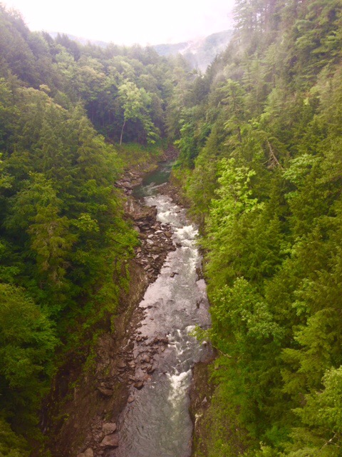
Day 130 Woodstock Stage Rd to Hanover, NH (21.0 miles) 1747.7 miles total

Crossed The Connecticut River into NH today.  Just NH and ME left to go!

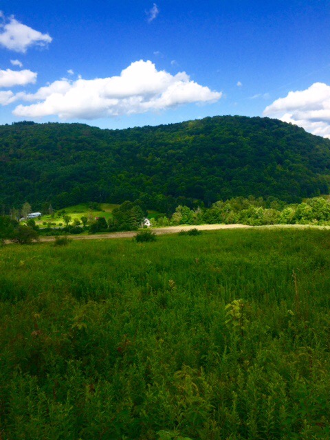
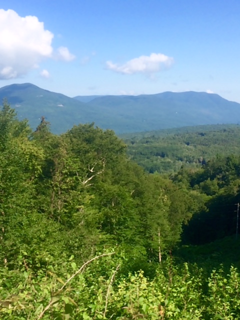
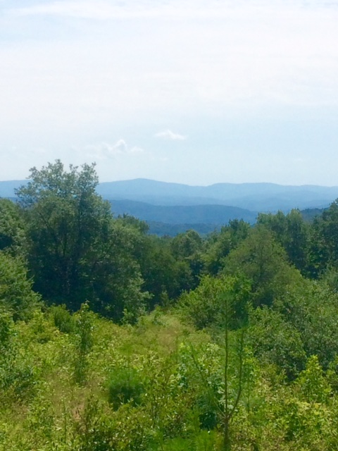
Looking back at Suicide Six Ski Area.  If you want the 411 on name, read Dick Mallery’s comment yesterday.  Thanks, Dick!

FullSizeRender

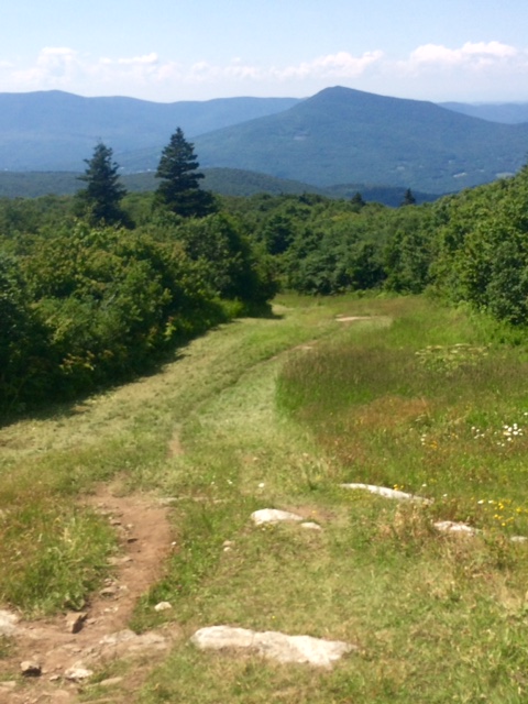
Was thinking today would be nice, easy stroll. Not…until last 2.5 miles. That was on streets and roads through Norwich, VT and into Hanover, NH.

One of first houses entering Norwich had a cooler by road marked “Trail Magic”. Cooler seemed very light so I assumed empty this late in day. Didn’t even open but lady out stacking firewood at house said there should be watermelon. There was. Refreshing treat!

FullSizeRender1

Hanover, NH is home of Dartmouth University. Craving a soda after 21 miles so asked a young lady near campus where closest convenience store is. She said I could go into student union and get a soda. I asked if a homeless looking guy could just walk in. She chuckled and said “Yes, we’re non-judgmental.” I walked 2 blocks to Circle K instead. Had a Mountain Dew while waiting for Sherpa to pick me up.

FullSizeRender3

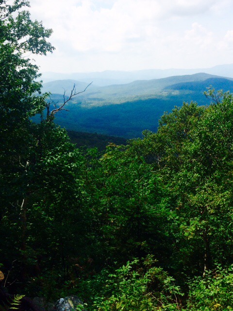
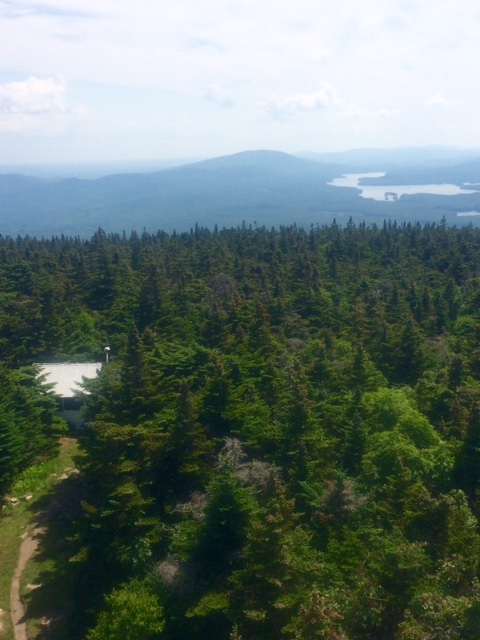
Sherpa did a little hiking himself today. He drove an hour and half to Mt Stratton, VT’s highest point. He’s trying to get to as many state high points as can so figured to knock off while here.

He was able to drive within 1.5 miles of top. From there, pretty tough walk to top and back. His knees were barking and was walking like me when he picked me up!

Sherpa leaves tomorrow so back to reality. About 50 miles to White Mountains where things really get real.

Happy trails!

August 6

Day 129 River Rd to Woodstock Stage Rd (20.3 miles) 1726.7 miles total

I’ve come across 2 places where there were metal rungs anchored in the rocks to facilitate climbing. Today was the first time there was a ladder. I was heading down. Not sure how that would have worked if ladder not there.


Got temporarily disoriented for a bit today. Long, complicated story but I walked an extra half mile or so. Hate when that happens!

Hiked up and over hill below. Very close to a small ski area called Suicide Six. Bit of a strange name.


Pretty nice to come out of woods at end of hike and have Sherpa there with ice cold sodas and a ride. Easy to get spoiled.

Hoping to reach NH, or pretty darn close, tomorrow. Working on getting myself psyched up for White Mountains. Will be there in a few days.

Happy trails!

August 5

Day 128 Killington, VT Zero Day 1706.4 miles total
Zero’d today. Off and on rain. Supposed to be nice tomorrow.

Did a bit of touring. Woodstock, VT and Queechee Gorge (below).


Back to our local spot for dinner and drinks. Our bartender, Mercedes, and everyone there made us feel like locals.


Planning on walking back to Woodstock tomorrow.

Happy trails!

August 4

Day 127 Robinson Brook to River Road (17.0 miles) 1706.4 miles total

You guys have pledged almost $27 for each mile I hike. We’re over $45,000 now and will be close to $60,000 for charities when I finish. Utterly amazing. Thanks so much for your support.

Rained a bit in mountains last night. Trail a bit wet and muddy.

Hiked with the “If I could hike 500 miles” song going through my head. Even sang (maybe more like chanted) it aloud a few times.

Sherpa met me at a road crossing 11 miles into hike. Took a half hour break. Slugged down 2 Mountain Dews, a Coke, and a tortilla stuffed with jerky. This eating/drinking whatever you want and can is way cool!


VT has been really weird in one aspect. There are no animals. I’ve not seen a deer. Pretty sure haven’t even seen a squirrel. Rare to hear a bird. It’s a bit eerie and almost feels like I’m in a Stephen King movie.

Below is Thundering Falls. Picture makes it look like a river but was a quite impressive waterfall. Comes down a rock face.


Staying in Killington tonight. Ate dinner at an interesting place, Back Behind Restaurant and BBQ. Good food, cold beer, and very nice staff and owners.

Rain forecast for most of day tomorrow. If that doesn’t change will zero and play tourist. Sherpa has wheels. Those car things come in real handy sometimes.

Happy trails!

August 3

Day 126 VT 140 to Robinson Brook (12.6 miles) 1689.4 miles total

If I can walk 1690 miles then I can walk 500 more. Making progress! I can remember when I had walked 500 miles and had 1690 to go. Like this much better!

12.6 mile hike today was relatively easy. Only took 4 3/4 hours. Light pack helps.

View of Rutland Airport.

IMG_1220

Met a SOBO (hiking ME to GA) today who anxiously told me he had just seen a bear and 2 cubs. I excitedly said “Cool. Where at?” He said wasn’t response he was expecting but were heading up mountain 2 to 3 minutes ago. Unfortunately I didn’t see them.

Came out of forest to a gravel road. Sherpa waiting. Nice to finish and have cold Mountain Dew! We met another NOBO, Giggles, who had started her hike on April 1. Day after my start.

Had good dinner, a few beers, and played trivia game at bar. Team Sherpa and Just Pete won a round but choked in finals with $50 gift card on the line.

IMG_1222

Tomorrow’s hike will begin with climb up and over Killington. Sherpa and I will meet at another gravel road. At least this one has a name!

Happy trails!

August 2

Day 125 Baker Peak Tentsite to VT 140 (12.8 miles) 1676.8 miles total

I’ve come across many ponds while hiking through VT. Below is Little Rock Pond. Water is very clear and saw a couple people swimming. I’m going to jump in one of these things eventually.

FullSizeRender

The weather for hiking has been good last 4 days. Looking like tomorrow will be good also. Then off and on chances of rain for a few days.

FullSizeRender1

Not sure how well this translates in pic, but these are stone cairns. Basically rock statues…lots of them. Doubting I would have patience to make one. At least it puts rocks to some use.

IMG_1219

Quite the adventure meeting up with my sherpa. We were to meet at VT 140 at 2. I got there about 1:50…no Skaare. Sat on side of road for about 15 minutes while leaving text and voice messages.

I had skimped on water today so was out of water and quite thirsty. Decided to hitch into Wallingford where we had planned to have lunch.

I ate lunch. Still no word from Skaare. Now I’m getting nervous with all sorts of bad scenarios running through my head. I finally decided to try to get to Rutland so ordered up an Uber.

Shortly thereafter Skaare pulls up. He had no cell service and had been doing trail magic at parking lot 1/4 mile from where I came out of woods. He had been asking other hikers if they had seen me. Finally got a guy, Snowbird, who told him he’d not only seen me but had lunch with me.

By this time I had mentally checked out of hiking mode so didn’t do remaining 6 miles originally planned.

Tomorrow we’re planning on meeting at a gravel road in the middle of nowhere. Wish us luck on that one!

Happy trails!

August 1

Day 124 Just Pete Tentsite to Baker Peak Tentsite (19.9 miles) 1663.0 miles total

The vistas keep getting more expansive and scenic in VT. I wish I could tell you what the peaks are but I can’t. If I were to take a guess, I’d say peak on left is Stratton Mtn. I do know that I’m on Spruce Peak.

FullSizeRender

Hitched a ride into Manchester Center for some supplies and lunch. Took a while to get a ride in and almost a half hour to get one back out.

Hitching seems to be getting tougher in New England. It’s either the mindset of people around here or the fact that I look much more like a hobo/crazed serial killer.

Last part of hike up Bromley Mtn was on a ski slope. Made me think of some good ski trips with the likes Jay, Doobie, Worm, Von, Smitty, Army, Head and Lars. Fondly remembered kicking your butts! Pretty sure I could stay in a tuck for quite a while right now.

FullSizeRender`1

This is from the top of Bromley. Once again, I think it’s Stratton in the background. I know from Stratton I could see ski slopes so I’m slightly confident it actually is Stratton.

FullSizeRende2r

This is from top of Styles Peak. Got a little trim of beard around nose and mouth in Bennington. Was blocking my nostrils and getting in mouth when I chewed. Barber really wanted to trim beard a little. Told him I didn’t want to look too groomed. He said “You don’t have to worry about that”!

Hat is getting to be like baseball cap that’s been worn all season. Some permanent salt marks.

FullSizeRende3r

Damn! I thought we were finished with Rocksylvania. Climb up rocks to top was about 3x this. Not fun when you’ve already hiked 18 miles.

FullSizeRender5

Incredible view from Baker Peak made it almost worth the effort. Not sure what that peak is but pretty sure not Stratton.

FullSizeRender6

I set up my tent about a half mile past the peak. Tired!

If all goes well tomorrow, will meet Skaare at a road crossing, have lunch, go back and hike 7 more miles, and he’ll pick me up near Rutland.

Happy trails!

July 31

Day 123 Just Pete Tentsite to Just Pete Tentsite (17.6 miles) 1644.1 miles total

No, I didn’t just walk in a circle back to same spot I tented last night. Just tenting in another off the grid spot and too lazy to make up a name!

FullSizeRender

Crossed over top of Stratton Mtn (3936 ft). Last part of it was pretty good climb (1350 ft in 2.3 miles).

This view is from the 55 ft lookout tower at top. You can see the caretaker’s cabin at lower left. Don’t know what caretaker does but he was sawing zzz’s when I went past cabin on trail. Had his door open and you can see how close trail is to cabin.

FullSizeRender1

This view is from same place only looking opposite direction which I think is north.

FullSizeRender2

Below is Stratton Pond. There were a couple hikers swimming there when I went past.

FullSizeRender3

Passed the 75% completion point today! Will be fewer than 500 miles to go in a few days.

Couple climbs tomorrow. Will go over Bromley Mtn ski area.

Happy trails!

July 30

Day 122 VT 9 to Just Pete Tentsite (15.9 miles) 1626.5 miles total

Rested up and ready to hike on.

Below are George and John. They’re the guys who hosted me yesterday. Kept me out a bit past hiker midnight (sunset) but I was able to sleep in. George and John picked me up about 10:30 and gave me a ride back to trailhead. Thanks for your hospitality, guys!

FullSizeRender

Great day for hiking. Sunny, low 70’s with a bit of breeze.

This view is looking down into Bennington. The hotel I stayed in was on Main St a little less than half mile from the thriving downtown business district. Walked that stretch a few times and looked directly at these power lines way up on the mountain. It’s about 1800 ft above town. Climb like that gets the blood flowing in the AM!

FullSizeRender1

After that climb, most of the remainder of day was on the ridge line.

Tomorrow will have one big climb to top of Stratton Mountain. 1700 ft elevation gain in 3.8 miles.

Happy trails!

July 29

Day 121 Bennington, VT Zero Day 1610.6 miles total

Nice relaxing day in Bennington. Like this town. Cool, walkable downtown area.

The AT diet is a calorie based program. You eat as many calories as possible. Breakfast…3 blueberry pancakes, 2 eggs, potatoes, and toast. Lunch…2 slices of pizza. Dinner…jambalaya.  


Met John, Director of Bennington Visitor Center, at local pub this afternoon. Invited me to his neighbor’s house. Got to hang around pool and drink beer for a couple hours. Almost felt like a normal human.


Will be making my way to Rutland, VT next. About 70 miles so hoping to be there Wednesday. Long time friend and high school classmate, Jerry, meeting me there. Coming in from AZ to sherpa a few days!

Happy trails!