September 10

Day 164 Kathadin Stream Campground to Mt Kathadin (5.2 miles) 2189.8 miles total

Kris and I headed to Baxter State Park early this AM. Parking in the park is very tightly controlled. We had a prepaid pass that you have to use by 7AM or you lose your spot.

Next had to register with ranger at campground. They keep close track of hikers going up mountain also. I was NOBO thru-hiker number 734. When I left GA 164 days ago I was number 1391 to head north.

Got started up mountain at 7:30. Told Kris I’d be finished about 2PM so we planned to meet at 1:30.

My knee was still pretty sore but once I got moving felt better.

FullSizeRender

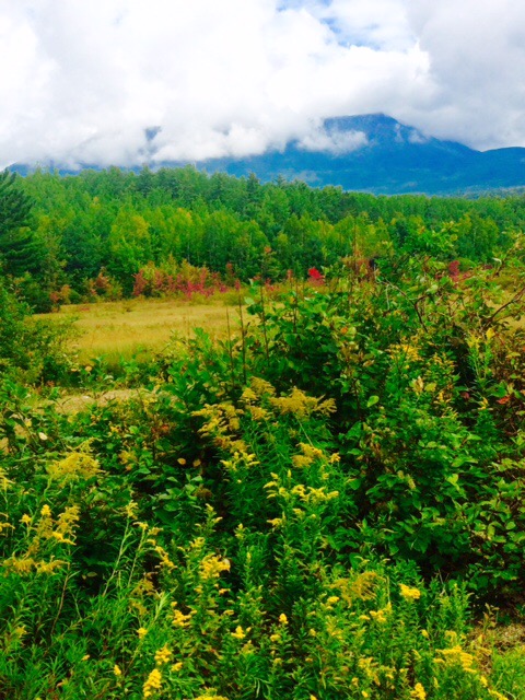
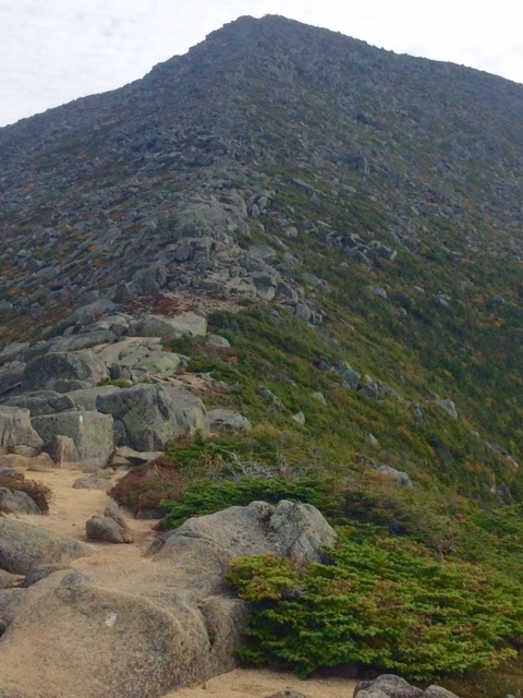
The climb up was very difficult in spots. Lot of rock climbing and rock scrambles.

FullSizeRender1

There are lots of day hikers out here on a weekend. I was passing a lot of them and wondering what the heck some of them were doing on this approach trail when there is an easier one. Amazes me also that people actually do this for fun. That’s crazy!

FullSizeRender2

Weather was partly cloudy. Thankful not wet. This could be dangerous if slippery and we all know I’m pretty good at crashing.

I was just cruising up. Day hikers could tell I was a focused, motivated thru-hiker and most offered congratulations as they got out of my way.

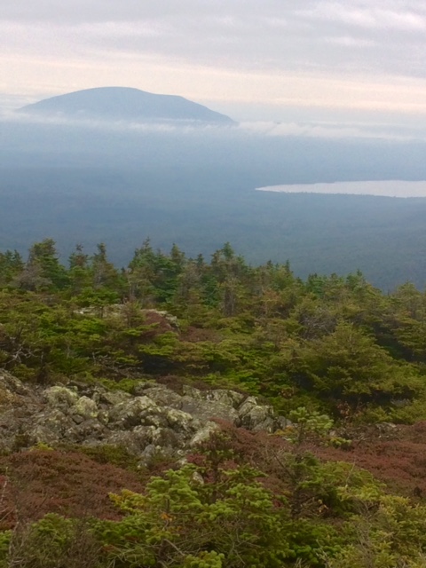
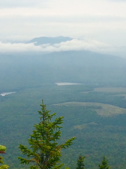
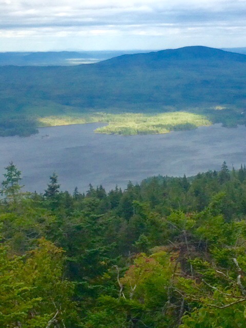
Coming up peak below I’m thinking that’s the summit. As I got real close, I could see a sign. I’m almost there. Got to that point and…false summit. Crap!! Got about another 3/4 mile to go but this time I can see the summit. At least I think I’m seeing summit.

image1 (7)

Now I’m really motivated and moving because I can see people gathered and know I’m nearing summit. The old man was really flying. I’m almost through thru-hiking kept running through my head.

image2 (4)

When I got within about 100 yds of summit I heard chant of “Pete, Pete, Pete…”. About a dozen hiker acquaintances (Goddess, P Tang, Happy Hour, Chimes, GQ, Bobo, Bubba) rooting the old dude to finish line. Got tears in my eye.

image3 (3)

I made it. Incredible feeling of accomplishment. Spent about half hour on summit laughing, tearing up and just celebrating with friends I will probably never see again.

IMG_1485

Said my good byes and headed back down. Came down the “easier” trail as I wanted to minimize chances of falling.

I was back down at 1PM. 5.5 hrs total. Just Pete just flew up and down.

Kris and I left from there heading towards Smugglers Notch, VT where we will spend the next week hiking…NOT!!

Thanks to all of you for your support and encouragement during this adventure. I will get back to you with where to send your donations next week. I need some time to rest, heal, and reassimilate into society!

I’ll make sure to post a pic when the beard comes off.

Thanks once again for your support. Couldn’t have done it without you.

Just Pete…OUT!

September 9

Day 163 Hurd Brook Tentsite to Kathadin Springs Campsite (13.4 miles) 2184.6 miles total

So this Kathadin thing keeps getting bigger and bigger as I get closer. Weird, huh?!!  


Made it to meeting place with Kris about 2PM. She had been in park doing trail magic. We hung out there for about an hour and a half. Drankles and Twinkle Toes summited today. Good to get their insight into the beast.


I’ve learned that after a fall it takes a bit to figure out what you really hurt. This time it’s my right knee. Must have bruised knee cap because really sore. Walking with a pretty good limp. Going to have to suck it up tomorrow morning!

Next time you hear from me I’ll be finished…finally!

Happy trails!

September 8

Day 162 Nahmakanta Stream Campsite to Hurd Brook Tentsite (25.4 miles) 2171.2 total miles 

Bet you can’t tell I’m anxious to finish! Hit it hard today.

Parts of today’s hike were more difficult than I expected. Had to go up and over Nesuntabunt Mtn (below). Elevation was only 1520′ but a 900′ climb up and back down. 


This view is to Mt Kathadin. 16 miles as the crow flies. 36 miles as a hiker hikes. Really tried transforming myself into a crow but didn’t work. And why is it as the crow flies? Are Eagles or robins not smart enough to go straight from point A to point B?


This Kathadin thing is looking more serious the closer I get. It’s going to be a 4200′ climb in 5.2 miles. Then there’s the back down thing. I would pay lots of $’s for a helicopter ride down if anyone can hook me up on Sunday. I despise miles that don’t count!


At 5PM I stopped for a break. Tried to figure out where I would tent for night. Hurd Brook Lean-to was 5.6 miles. About 2 hrs and I decided to go for it. Last lean-to on trail and figured there would be lots of people I know there.

I usually try to stop hiking by 6:30. Sun is setting earlier and starts getting dark shortly after 7. About 7 I was still short of Hurd Brook. Started looking for tentsites. Shortly after that I passed a decent spot but I knew shelter was close so I kept going.  

Horrible decision. Between lean-to and me was a brook that you had to rock hop over large boulders. It’s pretty dark now and I can’t really see best path across.

To make a long story short, I had a nasty slip and fall. Ended up holding on to boulder with one hand and catching walking stick with other before it careened into water. Pretty athletic move if I must say.

Bad news is I got really banged up. Of course left elbow got smashed once again along with left shin, right wrist and knee.

I decided to retreat. Went back 50 yds to tentsite I’d just passed. Luckily I can set tent up in dark. Lots of blood from elbow and shin. So sore I could hardly eat. Guessing I’ll be stiff and sore in AM.

Lesson learned…it ain’t over ’til it’s over. Hopefully that’s last fall because not sure I can physically take any more.

Only 18.6 more miles to go.

Happy trails!

September 7

Day 161 Mtn View Tentsite to Nahmakanta Stream Campsite (23.0 miles) 2145.8 miles total

Rained all night. Was afraid would rain all day today but slowed to a sprinkle about 8:30AM, I quickly packed and hit the trail.

Had to put on wet socks to go into wet shoes. The good thing with having wet shoes/socks is it doesn’t matter if you just slosh through wet areas. Bad thing is you can get trench foot. My feet were pretty wet and pasty by end of day.

After a couple miles I was into the flats. Not as flat and smooth as I hoped, but flat enough to move more quickly than I have for a while. Able to make 3 mph a lot of the time.


image1 (6)

Rain was off and on for most of AM and partly sunny in PM. Lucky that it didn’t pour all day so I had to sit in tent. Would have gotten pretty low on food by end of Wilderness. Will finish with very little as is.

Tented the other day by river fording with Bobo and Bubba. I know it sounds like a couple of good old southern boys but they’re really from MA. Nice guys. I’d strapped my extra socks on outside of pack in hopes they would dry a bit. Apparently they fell off at some point as Bobo and Bubba caught up with me and had them.

That’s Mt Kathadin you can see in the clouds. Sneaking up on that bad boy. Pic is from about 50 trail miles away from summit.

FullSizeRender

Tenting tonight in a nice flat spot in a designated campsite. I’m only one here. All the youngsters stay at shelters, or lean to’s as they call them in ME. Pretty sure that’s why a lot of them have coughs. Bobo and Bubba told me last night in rain there were 11 people in lean to that is meant for about 8.

All my stuff is pretty wet. Gonna be wet socks and shoes again tomorrow as I accidentally forded (slipped in) a stream shortly before camp. That sucks!

Hoping to get as close to Baxter State Park as I can tomorrow. That will be the first of many lasts for me. Last night in a tent, etc.

Saturday Kris will meet me at Kathadin Stream Campground in park. We’ll stay at a motel in Millinocket that night and go back to Campground Sunday AM. Then it’s 5.2 miles up to top of Kathadin and the end of this odyssey…except for the 5.2 miles back down!

Crazy close to being finished!

Happy trails!

September 6

Day 160 Pleasant River Tentsite to Mtn View Tentsite (17.2 miles) 2122.8 miles total

Light rain all night. Stopped for a bit shortly after 7:30AM. Got packed up and hit the trail.

Rain would come and go all the while I hiked. Not very hard. Just a nuisance. I do not like hiking in the rain. I do not like it at all.

FullSizeRender

White Cap Mtn (3650′) was a climb of 3000′ over 11.4 miles so not a steep climb but a long one. Highest point until Mt Kathadin. You can see Kathadin in pic below. Looks pretty big above the clouds. All by itself which is reason it’s pretty flat until you get there.

FullSizeRender1

You make lots of decisions each day you’re hiking. Some are trivial and some aren’t. Today I tried to push for more mileage and passed a nice flat camping area. Bad decision. About 3/4 mile later rain started picking up. Now I needed to stop and there are no good tentsites as I’m on side of hill.

Ended up with worst tentsite of trek. Slanted and rocky. Not comfortable and raining hard now.

When I left Monson, rain was forecast for today and tomorrow. They got today right. Hoping tomorrow is wrong. I really don’t want to be stuck in tent in pouring rain this close to finish.

Happy trails!

September 5

Day 159 Long Pond Stream Campsite to Pleasant River Campsite (16.0 miles) 2105.6 miles total

You’d think this has got to get easier at some point in time but just keeps coming at you. Crossed 6 mountain tops today. All in the 2000′ elevation but still up and down. So many mountains that they started running out of names. Crossed Mt Three and a Half. It was right between Fourth Mtn and Third Mtn…of course.

FullSizeRender

Miles are still hard fought in this area. Lots of ups, downs, rocks, and roots. Perfect recipe for a painful fall.

Heard about a thru-hiker who fell and broke her wrist today. A couple came upon her and there was a side trail that went 1.5 miles to a gravel road. Amazingly had cell service and were able to call Shaw’s Hiker Hostel in Monson. They were coming to pick her up. Feel so sorry for her.

FullSizeRender2

Had to do my first, and I hope only, river fording today. About 30 ft wide river 15 inches deep. Have been able to rock hop the others but not possible here. I’m tented just past river. Wanted to get past in case river gets higher.

Rain in forecast for next few days. Looked like rain pretty much all day today but didn’t start until 7PM.

One more big climb tomorrow, White Mtn, then pretty flat to Mt Kathadin

Happy trails!

September 4

Day 158 ME 15 to Long Pond Stream Tentsite (14.3 miles) 2089.6 miles total

Happy 25th birthday, Kerri Peterson!

Rained pretty good last night so trail was pretty slippery today. Makes for some slow going.

Welcome to the 100 Mile Wilderness. I wonder if the sign scares anyone away. I would think most people know what they’re getting into here.

100 mile sign

Had a few slips and falls today. Falling on rocks is no fun. Smashed my left elbow on a rock…again. That thing has taken a beating. Pretty sure I’ve had more cuts, scrapes, and injuries on this trek than previous 25 years combined.

Did find a nice lunch spot with a stone chair…with a back!

FullSizeRender

Fall is definitely beginning here. Seeing more trees with leaves changing color every day. I started in GA when trees were just budding.

FullSizeRender1

Next 35 miles of Wilderness is quite a bit of ups and downs and then 50 miles of relatively flat cruising. Anxious to reach that point. Lower likelihood of injury.

Happy trails!

September 3

Day 157 Monson, ME Zero Day, 2075.3 miles total

Staying at Shaw’s Hiker Hostel in Monson. They have the main house and 2 bunkhouses. Also allow tents in yard. Must be at least 30 hikers here.

They serve a great breakfast in AM. 3 eggs, potatoes, bacon, and unlimited blueberry pancakes.  

Got supplies for 6-day trek through 100 Mile Wilderness. Tortillas, peanut butter, tuna, beef jerky, trail mix, and a bunch of candy bars will be my diet for next 6 days.

Food drop thing isn’t like I envisioned. You pay $80 and they meet you at a road crossing in Wilderness at a specific date/time. Decided not to do it. Good thing about food is that what you carry gets lighter each day. Only problem is you end up carrying a lot of trash.

I don’t expect much communication service for next several days. Blog delivery will be random at best. I’ll be stretching to keep phone charged for 6 days as well.

Happy trails!

September 2

Day 156 Bald Mtn Stream Tentsite to ME 15, Monson, ME (15.4 miles) 2075.3 miles total

Good, quick hike into Monson. No big ups/downs so really was like a walk in the woods.

Been very fortunate that it hasn’t rained for almost 2 weeks. Besides the fact I’m not getting wet, the boggy areas are fairly dry and a couple streams that you normally need to ford are low enough you can rock hop.

Stream below would have to be forded most of the time. Hold on to rope that you see and wade through knee deep water. Today, however, I was able to walk across on piles of branches you see.

Monson is a really small town. 2 bars and neither has ESPN. Hitched a ride 10 miles to another town with Chewy just to watch some college football. Finagled a ride back from waiter as it was dark by then. Quite the adventure!

Decided that I will take a Zero tomorrow to rest up for final 115 miles. That means I should finish next Sunday.  

Happy trails!

September 1

Day 155 US 201 to Bald Mtn Stream (21.1 miles) 2059.9 miles total

Today was about getting myself as close to Monson as I could. 15 miles away so I’m pleased.

The number of lakes and ponds in ME is amazing. Some are very large. There also are few cabins or residences on most that I’ve been near…probably because it would be a long walk to get there.

Crossed 2 peaks today, Pleasant Pond Mtn (2470′) and Moxie Bald Mtn (2829′). May not sound very tall, but when you start at 1000′ it’s still some work.


Wind was howling most of day. Blew my hat off on Moxie Bald (below). Luckily it got caught in some brush or would have been sayonara to hat. Trail was not well marked here. If I didn’t have app on phone would have taken me some time to figure it out.


The bright green area is sun shining through on island. I thought it looked cool.


Hoping to get into Monson by 3PM. Usual routine of shower, laundry, resupply, dinner, a few Buds, and, now, football…lots of football.  

There is allegedly a system to get supplies half way through the 100 Mile Wilderness. Buy in Monson and someone, somehow, leaves a bucket along trail for you. Curious as to how this works. Big difference (about 6 lbs) between carrying 3 days of food vs 6 days.

Happy trails!